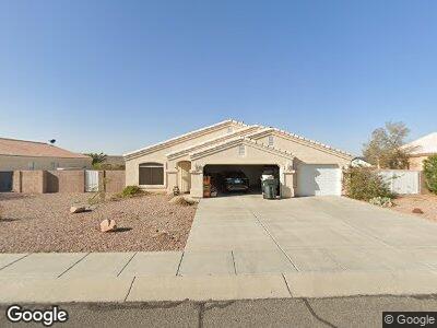
5079 S Silver Bullet Dr Fort Mohave, AZ 86426
Fort Mohave NeighborhoodEstimated Value: $323,811 - $343,000
3
Beds
2
Baths
1,450
Sq Ft
$231/Sq Ft
Est. Value
About This Home
This home is located at 5079 S Silver Bullet Dr, Fort Mohave, AZ 86426 and is currently estimated at $334,453, approximately $230 per square foot. 5079 S Silver Bullet Dr is a home located in Mohave County with nearby schools including Fort Mohave Elementary School, Camp Mohave Elementary School, and Mohave Valley Junior High School.
Ownership History
Date
Name
Owned For
Owner Type
Purchase Details
Closed on
Feb 25, 2003
Sold by
Bidoco Inc
Bought by
Roy Christopher M and Brohman Sonyia M
Current Estimated Value
Home Financials for this Owner
Home Financials are based on the most recent Mortgage that was taken out on this home.
Original Mortgage
$142,980
Interest Rate
5.79%
Purchase Details
Closed on
Oct 22, 2002
Sold by
W S T
Bought by
Bidoco Inc
Purchase Details
Closed on
Apr 1, 2002
Sold by
Szymkowiak Stephen R and Szymkowiak Danica
Bought by
W S T
Create a Home Valuation Report for This Property
The Home Valuation Report is an in-depth analysis detailing your home's value as well as a comparison with similar homes in the area
Home Values in the Area
Average Home Value in this Area
Purchase History
| Date | Buyer | Sale Price | Title Company |
|---|---|---|---|
| Roy Christopher M | $142,980 | First American Title Ins Co | |
| Bidoco Inc | $20,000 | First American Title Ins Co | |
| W S T | $16,500 | First American Title |
Source: Public Records
Mortgage History
| Date | Status | Borrower | Loan Amount |
|---|---|---|---|
| Open | Roy Christopher M | $155,000 | |
| Closed | Roy Christopher M | $169,025 | |
| Closed | Roy Christopher M | $194,000 | |
| Closed | Roy Christopher M | $142,980 |
Source: Public Records
Tax History Compared to Growth
Tax History
| Year | Tax Paid | Tax Assessment Tax Assessment Total Assessment is a certain percentage of the fair market value that is determined by local assessors to be the total taxable value of land and additions on the property. | Land | Improvement |
|---|---|---|---|---|
| 2025 | $1,398 | $24,174 | $0 | $0 |
| 2024 | $1,398 | $27,767 | $0 | $0 |
| 2023 | $1,398 | $22,556 | $0 | $0 |
| 2022 | $1,372 | $18,118 | $0 | $0 |
| 2021 | $1,438 | $16,817 | $0 | $0 |
| 2019 | $1,336 | $15,109 | $0 | $0 |
| 2018 | $1,297 | $14,628 | $0 | $0 |
| 2017 | $1,286 | $14,175 | $0 | $0 |
| 2016 | $1,122 | $12,849 | $0 | $0 |
| 2015 | $1,138 | $11,935 | $0 | $0 |
Source: Public Records
Map
Nearby Homes
- 1711 E Sugar Bush Place
- 1797 E Bear Creek Way
- 5119 S Amber Sands Dr
- 5056 S Amber Sands Dr
- 1836 E Bear Creek Way
- 2202 E Moon Ridge Ln
- 2203 Twins Dr
- 6191 S Pawnee Way
- 2196 Hayden Way
- 2191 Twins Dr
- 2185 Twins Dr
- 1728 E Alcazar Way
- 1712 E Alcazar Way
- 4992 S El Ranchero Rd
- 5150 S El Ganadero Dr
- 1584 E El Rodeo Rd
- 4979 S Via Colinas Dr
- 5490 Cholla Dr
- 1744 E Hammer Ln
- 1668 Hammer Ln