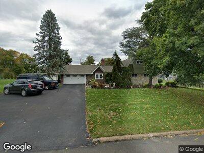
51 Silverbell Rd Levittown, PA 19056
Snowball Gate NeighborhoodEstimated Value: $496,294 - $532,000
4
Beds
3
Baths
2,266
Sq Ft
$228/Sq Ft
Est. Value
About This Home
This home is located at 51 Silverbell Rd, Levittown, PA 19056 and is currently estimated at $516,824, approximately $228 per square foot. 51 Silverbell Rd is a home located in Bucks County with nearby schools including Albert Schweitzer Elementary School, Sandburg Middle School, and Neshaminy High School.
Ownership History
Date
Name
Owned For
Owner Type
Purchase Details
Closed on
Sep 30, 2009
Sold by
Lang Sue N
Bought by
Philipp Nancy
Current Estimated Value
Home Financials for this Owner
Home Financials are based on the most recent Mortgage that was taken out on this home.
Original Mortgage
$220,000
Interest Rate
5.14%
Mortgage Type
New Conventional
Purchase Details
Closed on
Aug 27, 1996
Sold by
Lang Sue N
Bought by
Lang Sue N
Create a Home Valuation Report for This Property
The Home Valuation Report is an in-depth analysis detailing your home's value as well as a comparison with similar homes in the area
Home Values in the Area
Average Home Value in this Area
Purchase History
| Date | Buyer | Sale Price | Title Company |
|---|---|---|---|
| Philipp Nancy | $275,000 | First American Title Ins Co | |
| Lang Sue N | -- | -- |
Source: Public Records
Mortgage History
| Date | Status | Borrower | Loan Amount |
|---|---|---|---|
| Open | Philipp Nancy | $179,900 | |
| Closed | Phillipp Nancy K | $228,000 | |
| Closed | Philipp Nancy | $213,000 | |
| Closed | Philipp Nancy | $220,000 |
Source: Public Records
Tax History Compared to Growth
Tax History
| Year | Tax Paid | Tax Assessment Tax Assessment Total Assessment is a certain percentage of the fair market value that is determined by local assessors to be the total taxable value of land and additions on the property. | Land | Improvement |
|---|---|---|---|---|
| 2024 | $6,183 | $28,400 | $6,960 | $21,440 |
| 2023 | $6,085 | $28,400 | $6,960 | $21,440 |
| 2022 | $5,925 | $28,400 | $6,960 | $21,440 |
| 2021 | $5,925 | $28,400 | $6,960 | $21,440 |
| 2020 | $5,854 | $28,400 | $6,960 | $21,440 |
| 2019 | $5,723 | $28,400 | $6,960 | $21,440 |
| 2018 | $5,618 | $28,400 | $6,960 | $21,440 |
| 2017 | $5,475 | $28,400 | $6,960 | $21,440 |
| 2016 | $5,475 | $28,400 | $6,960 | $21,440 |
| 2015 | $5,664 | $28,400 | $6,960 | $21,440 |
| 2014 | $5,664 | $28,400 | $6,960 | $21,440 |
Source: Public Records
Map
Nearby Homes
- 48 Silverbell Rd
- 37 Underwood Rd
- 66 Sweetgum Rd
- 0 Durham Rd
- 1835 Durham Rd
- 67 Hollybrooke Dr
- 120 Hollybrooke Dr
- 48 Lower Orchard Dr
- 34 Jasmine Rd
- L:070 Trenton Rd
- 68 Forsythia Dr N
- 61 Liberty Cir Unit 61
- 118 Plumtree Rd
- 720 Clay Ave
- 21 Hawk Rd
- 34 Inkberry Rd
- 5 Harp Rd
- 347 Zimmerman Ln
- 134 Indian Creek Dr
- 434 Quincy Ave