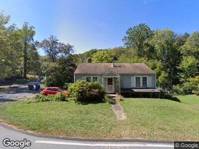
51 Wolfe Cove Rd Asheville, NC 28804
Beaverdam NeighborhoodEstimated Value: $368,993 - $548,000
3
Beds
2
Baths
2,264
Sq Ft
$192/Sq Ft
Est. Value
About This Home
This home is located at 51 Wolfe Cove Rd, Asheville, NC 28804 and is currently estimated at $433,748, approximately $191 per square foot. 51 Wolfe Cove Rd is a home located in Buncombe County with nearby schools including Ira B Jones Elementary, Isaac Dickson Elementary, and Hall Fletcher Elementary.
Ownership History
Date
Name
Owned For
Owner Type
Purchase Details
Closed on
Nov 26, 2007
Sold by
Ball John F
Bought by
Ball Catherine Durner
Current Estimated Value
Home Financials for this Owner
Home Financials are based on the most recent Mortgage that was taken out on this home.
Original Mortgage
$80,000
Interest Rate
6.36%
Mortgage Type
Unknown
Purchase Details
Closed on
Oct 1, 2003
Sold by
Durner Audrey Elizabeth and Durner Henry Joseph
Bought by
Ball John F and Ball Catherine Durner
Home Financials for this Owner
Home Financials are based on the most recent Mortgage that was taken out on this home.
Original Mortgage
$78,000
Interest Rate
5%
Mortgage Type
Unknown
Create a Home Valuation Report for This Property
The Home Valuation Report is an in-depth analysis detailing your home's value as well as a comparison with similar homes in the area
Home Values in the Area
Average Home Value in this Area
Purchase History
| Date | Buyer | Sale Price | Title Company |
|---|---|---|---|
| Ball Catherine Durner | -- | None Available | |
| Ball John F | $75,000 | -- |
Source: Public Records
Mortgage History
| Date | Status | Borrower | Loan Amount |
|---|---|---|---|
| Open | Ball Catherine D | $54,000 | |
| Open | Ball Catherine Durner | $90,000 | |
| Closed | Ball Catherine Durner | $88,000 | |
| Closed | Ball Catherine Durner | $50,000 | |
| Closed | Ball Catherine Durner | $80,000 | |
| Previous Owner | Ball John F | $78,000 |
Source: Public Records
Tax History Compared to Growth
Tax History
| Year | Tax Paid | Tax Assessment Tax Assessment Total Assessment is a certain percentage of the fair market value that is determined by local assessors to be the total taxable value of land and additions on the property. | Land | Improvement |
|---|---|---|---|---|
| 2023 | $1,742 | $168,600 | $58,900 | $109,700 |
| 2022 | $1,681 | $168,600 | $0 | $0 |
| 2021 | $1,681 | $168,600 | $0 | $0 |
| 2020 | $1,700 | $157,700 | $0 | $0 |
| 2019 | $1,700 | $157,700 | $0 | $0 |
| 2018 | $1,700 | $157,700 | $0 | $0 |
| 2017 | $1,716 | $136,500 | $0 | $0 |
| 2016 | $1,678 | $136,500 | $0 | $0 |
| 2015 | $1,678 | $136,500 | $0 | $0 |
| 2014 | $1,657 | $136,500 | $0 | $0 |
Source: Public Records
Map
Nearby Homes
- 25 Bassett Rd
- 52 Beaverdam Knoll Rd
- 18 Wolfe Cove Rd
- 13 Bassett Rd
- 111 Spooks Branch Rd
- 7 Brookcliff Dr
- 19 Brookcliff Dr
- 101 Skyview Dr
- 14 Twinflower Trail
- 197 Collin Place Unit 30
- 163 Collin Place Unit 20
- 173 Collin Place Unit 23
- 175 Collin Place Unit 24
- 171 Collin Place Unit 22
- 36 Brookcliff Dr
- 167 Collin Place Unit 21
- 155 Collin Place Unit 17
- 42 Spring Cove Rd
- 74 Longspur Ln
- 28 Woodland Aster Way