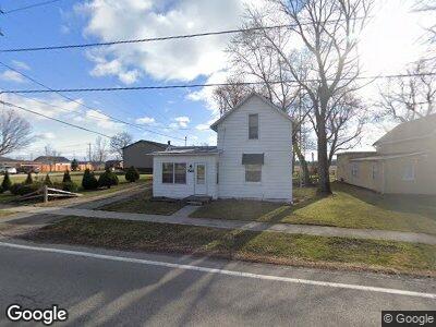
516 S Main St Mount Blanchard, OH 45867
Mount Blanchard NeighborhoodEstimated Value: $87,613 - $159,000
3
Beds
1
Bath
1,042
Sq Ft
$124/Sq Ft
Est. Value
About This Home
This home is located at 516 S Main St, Mount Blanchard, OH 45867 and is currently estimated at $129,403, approximately $124 per square foot. 516 S Main St is a home with nearby schools including Riverdale Middle School and Riverdale High School.
Ownership History
Date
Name
Owned For
Owner Type
Purchase Details
Closed on
Feb 21, 2024
Sold by
Lee Arnold
Bought by
Garza Tricia M
Current Estimated Value
Purchase Details
Closed on
Nov 22, 1996
Sold by
Est John Iams
Bought by
Arnold Lee and Arnold Merri
Home Financials for this Owner
Home Financials are based on the most recent Mortgage that was taken out on this home.
Original Mortgage
$37,000
Interest Rate
8.5%
Mortgage Type
New Conventional
Purchase Details
Closed on
Oct 11, 1991
Bought by
Iams John L and Iams John L
Create a Home Valuation Report for This Property
The Home Valuation Report is an in-depth analysis detailing your home's value as well as a comparison with similar homes in the area
Home Values in the Area
Average Home Value in this Area
Purchase History
| Date | Buyer | Sale Price | Title Company |
|---|---|---|---|
| Garza Tricia M | -- | None Listed On Document | |
| Arnold Lee | $37,000 | -- | |
| Iams John L | -- | -- |
Source: Public Records
Mortgage History
| Date | Status | Borrower | Loan Amount |
|---|---|---|---|
| Previous Owner | Arnold Lee | $30,250 | |
| Previous Owner | Arnold Carroll Lee | $28,688 | |
| Previous Owner | Arnold Lee | $37,000 |
Source: Public Records
Tax History Compared to Growth
Tax History
| Year | Tax Paid | Tax Assessment Tax Assessment Total Assessment is a certain percentage of the fair market value that is determined by local assessors to be the total taxable value of land and additions on the property. | Land | Improvement |
|---|---|---|---|---|
| 2023 | $666 | $18,650 | $3,900 | $14,750 |
| 2022 | $698 | $18,650 | $3,900 | $14,750 |
| 2021 | $564 | $13,120 | $3,910 | $9,210 |
| 2020 | $555 | $13,120 | $3,910 | $9,210 |
| 2019 | $575 | $13,120 | $3,910 | $9,210 |
| 2018 | $477 | $11,020 | $3,260 | $7,760 |
| 2017 | $477 | $11,020 | $3,260 | $7,760 |
| 2016 | $470 | $11,020 | $3,260 | $7,760 |
| 2015 | $281 | $6,720 | $2,030 | $4,690 |
| 2014 | $260 | $6,720 | $2,030 | $4,690 |
| 2012 | $266 | $6,720 | $2,030 | $4,690 |
Source: Public Records
Map
Nearby Homes
- 16672 State Route 103
- 20453 Township Road 187
- 15900 Township Road 191
- 0 Powell Dr Lot 3 Unit 6091840
- 0 Powell Dr Lot 5 Unit 6091838
- 9556 County Highway 78
- 13074 Township Road 152
- 19048 Township Road 42
- 14175 Ohio 37
- 127 Union St
- 110 Apple Grove Ln
- 716 Apple Blossom Ln
- 111 S Cumberland St
- 19252 Township Highway 49
- 122 N Cumberland St
- 15110 County Road 197
- 445 Willow Dr
- 20841 State Route 68
- 6497 Ch87 Wharton
- 101 Franklin St