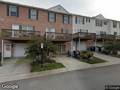
519 Northwynd Cir Lynchburg, VA 24502
Wyndhurst NeighborhoodEstimated Value: $293,085 - $308,000
3
Beds
4
Baths
2,400
Sq Ft
$125/Sq Ft
Est. Value
About This Home
This home is located at 519 Northwynd Cir, Lynchburg, VA 24502 and is currently estimated at $301,021, approximately $125 per square foot. 519 Northwynd Cir is a home located in Lynchburg City with nearby schools including Heritage Elementary School, Sandusky Middle School, and Heritage High School.
Ownership History
Date
Name
Owned For
Owner Type
Purchase Details
Closed on
Jul 16, 2008
Sold by
Parsons Leslie G and Parsons Ila Joan
Bought by
Umayam Ii Federico and Umayam January Dumlao
Current Estimated Value
Home Financials for this Owner
Home Financials are based on the most recent Mortgage that was taken out on this home.
Original Mortgage
$198,171
Outstanding Balance
$131,703
Interest Rate
6%
Mortgage Type
VA
Estimated Equity
$171,922
Purchase Details
Closed on
Jun 11, 2008
Sold by
Parsons Leslie G and Parsons Ila Joan
Bought by
Umayam Ii Frederico and Dumlao Umayam January
Home Financials for this Owner
Home Financials are based on the most recent Mortgage that was taken out on this home.
Original Mortgage
$198,171
Outstanding Balance
$131,703
Interest Rate
6%
Mortgage Type
VA
Estimated Equity
$171,922
Create a Home Valuation Report for This Property
The Home Valuation Report is an in-depth analysis detailing your home's value as well as a comparison with similar homes in the area
Home Values in the Area
Average Home Value in this Area
Purchase History
| Date | Buyer | Sale Price | Title Company |
|---|---|---|---|
| Umayam Ii Frederico | -- | None Available |
Source: Public Records
Mortgage History
| Date | Status | Borrower | Loan Amount |
|---|---|---|---|
| Open | Umayam Ii Frederico | $198,171 | |
| Previous Owner | Parsons Leslie G | $183,000 |
Source: Public Records
Tax History Compared to Growth
Tax History
| Year | Tax Paid | Tax Assessment Tax Assessment Total Assessment is a certain percentage of the fair market value that is determined by local assessors to be the total taxable value of land and additions on the property. | Land | Improvement |
|---|---|---|---|---|
| 2024 | $2,164 | $243,200 | $24,500 | $218,700 |
| 2023 | $2,164 | $243,200 | $24,500 | $218,700 |
| 2022 | $1,945 | $188,800 | $24,500 | $164,300 |
| 2021 | $2,096 | $188,800 | $24,500 | $164,300 |
| 2020 | $1,933 | $174,100 | $24,500 | $149,600 |
| 2019 | $1,933 | $174,100 | $24,500 | $149,600 |
| 2018 | $1,837 | $165,500 | $24,500 | $141,000 |
| 2017 | $1,837 | $165,500 | $24,500 | $141,000 |
| 2016 | $1,837 | $165,500 | $24,500 | $141,000 |
| 2015 | $1,378 | $165,500 | $24,500 | $141,000 |
| 2014 | $1,837 | $194,000 | $24,500 | $169,500 |
Source: Public Records
Map
Nearby Homes
- 224 Duncraig Dr
- 605 Wyndhurst Dr Unit 101
- 213 Duncraig Dr
- 509 Wyndhurst Dr
- 128 Seven Oaks Dr
- 101 Duncraig Dr Unit 210
- 111 Wyndview Dr
- 317 Wyndhurst Dr
- 109 Pearson Dr
- 205 Bella Ct
- 407 Old Graves Mill Rd
- 106 Salisbury Cir
- 8001 Timberlake Rd
- 117 Acres Ct
- 101 Mountain View Dr
- 328 Paulette Cir
- 404 Paulette Cir
- 8108 Timberlake Rd Unit 135
- 29 Mountain View Dr
- 348 Smoketree Ln