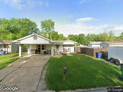
52 Cedar Croft Dr Pacific, MO 63069
Pacific NeighborhoodEstimated Value: $166,618 - $176,000
3
Beds
2
Baths
960
Sq Ft
$179/Sq Ft
Est. Value
About This Home
This home is located at 52 Cedar Croft Dr, Pacific, MO 63069 and is currently estimated at $171,655, approximately $178 per square foot. 52 Cedar Croft Dr is a home located in Franklin County with nearby schools including Pacific High School and St Bridget Elementary School.
Ownership History
Date
Name
Owned For
Owner Type
Purchase Details
Closed on
May 9, 2016
Sold by
Dennis Ryan and Dennis Jessica Marie
Bought by
Denny Robert
Current Estimated Value
Home Financials for this Owner
Home Financials are based on the most recent Mortgage that was taken out on this home.
Original Mortgage
$77,600
Outstanding Balance
$62,631
Interest Rate
3.59%
Mortgage Type
New Conventional
Estimated Equity
$103,852
Purchase Details
Closed on
Dec 3, 2012
Sold by
The Secretary Of Hud
Bought by
Dennis Ryan and Dennis Jessica Marie
Home Financials for this Owner
Home Financials are based on the most recent Mortgage that was taken out on this home.
Original Mortgage
$55,402
Interest Rate
3.5%
Mortgage Type
FHA
Purchase Details
Closed on
Jul 12, 2012
Sold by
U S Bank N A
Bought by
Secretary Of Hud
Purchase Details
Closed on
Apr 23, 2012
Sold by
South & Associates Pc
Bought by
U S Bank National Assocatin
Purchase Details
Closed on
Jun 9, 2010
Sold by
Nickles Joseph and Nickles Sheryl
Bought by
Davenport Phillip and Davenport Ruth A
Home Financials for this Owner
Home Financials are based on the most recent Mortgage that was taken out on this home.
Original Mortgage
$112,485
Interest Rate
5.4%
Mortgage Type
FHA
Purchase Details
Closed on
Jul 10, 2009
Sold by
Fagan Patrick A
Bought by
Nickles Joseph and Nickles Sheryl
Purchase Details
Closed on
Feb 11, 2007
Sold by
Vaught Steven W
Bought by
Vaught Colleen C
Create a Home Valuation Report for This Property
The Home Valuation Report is an in-depth analysis detailing your home's value as well as a comparison with similar homes in the area
Home Values in the Area
Average Home Value in this Area
Purchase History
| Date | Buyer | Sale Price | Title Company |
|---|---|---|---|
| Denny Robert | $77,600 | -- | |
| Dennis Ryan | -- | None Available | |
| Secretary Of Hud | -- | None Available | |
| U S Bank National Assocatin | -- | None Available | |
| Davenport Phillip | -- | None Available | |
| Nickles Joseph | -- | None Available | |
| Vaught Colleen C | -- | None Available |
Source: Public Records
Mortgage History
| Date | Status | Borrower | Loan Amount |
|---|---|---|---|
| Open | Denny Robert | $77,600 | |
| Previous Owner | Dennis Ryan | $55,402 | |
| Previous Owner | Davenport Phillip | $112,485 |
Source: Public Records
Tax History Compared to Growth
Tax History
| Year | Tax Paid | Tax Assessment Tax Assessment Total Assessment is a certain percentage of the fair market value that is determined by local assessors to be the total taxable value of land and additions on the property. | Land | Improvement |
|---|---|---|---|---|
| 2024 | $1,536 | $20,340 | $0 | $0 |
| 2023 | $1,536 | $20,340 | $0 | $0 |
| 2022 | $1,318 | $18,991 | $0 | $0 |
| 2021 | $1,312 | $18,991 | $0 | $0 |
| 2020 | $1,221 | $17,670 | $0 | $0 |
| 2019 | $1,220 | $17,670 | $0 | $0 |
| 2018 | $1,139 | $16,163 | $0 | $0 |
| 2017 | $1,131 | $16,163 | $0 | $0 |
| 2016 | $1,169 | $16,540 | $0 | $0 |
| 2015 | $1,137 | $16,540 | $0 | $0 |
| 2014 | $1,118 | $16,540 | $0 | $0 |
Source: Public Records
Map
Nearby Homes
- 57 Cedar Brook Dr
- 60 Cedar Brook Dr
- 97 Lamar Pkwy
- 2 Hogan Rd
- 1747 Kristi Ln
- 2364 Silver Lake Estates Dr
- 6833 Eagles Landing Ct
- 0 Bar Rd Unit MAR25005816
- 1 Hogan
- 1403 W Saint Louis St
- 1331 W Congress St
- 124 Hogan Ave
- 1926 Ridge Ln
- 1829 Ridge Ln
- 1665 Westlake Cir
- 1221 Thornton St
- 2266 Woodlock Dr
- 1036 Center St
- 1102 Pinewood Dr
- 2155 Buffalo Bluff