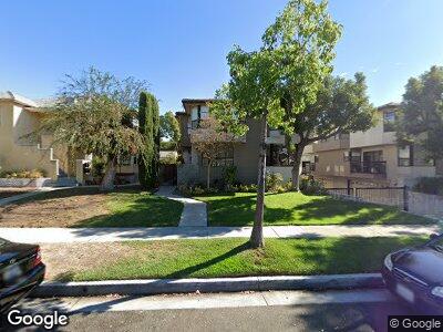
520 N Isabel St Unit C Glendale, CA 91206
City Center NeighborhoodEstimated Value: $725,000 - $843,000
3
Beds
3
Baths
1,550
Sq Ft
$509/Sq Ft
Est. Value
About This Home
This home is located at 520 N Isabel St Unit C, Glendale, CA 91206 and is currently estimated at $789,403, approximately $509 per square foot. 520 N Isabel St Unit C is a home located in Los Angeles County with nearby schools including R.D. White Elementary School, Woodrow Wilson Middle School, and Glendale High School.
Ownership History
Date
Name
Owned For
Owner Type
Purchase Details
Closed on
May 7, 2010
Sold by
Walters Donald J
Bought by
Walters Donald J and The Donald J Walters Jr Revocable Trust
Current Estimated Value
Purchase Details
Closed on
Jan 14, 1994
Sold by
General Electric Mtg Insurance Corp
Bought by
Walters Donald J
Home Financials for this Owner
Home Financials are based on the most recent Mortgage that was taken out on this home.
Original Mortgage
$141,600
Interest Rate
7.16%
Purchase Details
Closed on
Oct 20, 1993
Sold by
Texas Commerce Bank National Assn
Bought by
General Electric Mtg Insurance Corp
Create a Home Valuation Report for This Property
The Home Valuation Report is an in-depth analysis detailing your home's value as well as a comparison with similar homes in the area
Home Values in the Area
Average Home Value in this Area
Purchase History
| Date | Buyer | Sale Price | Title Company |
|---|---|---|---|
| Walters Donald J | -- | None Available | |
| Walters Donald J | $177,000 | First American Title | |
| General Electric Mtg Insurance Corp | -- | First American Title |
Source: Public Records
Mortgage History
| Date | Status | Borrower | Loan Amount |
|---|---|---|---|
| Open | Walters Donald J | $100,000 | |
| Closed | Walters Donald J | $141,600 |
Source: Public Records
Tax History Compared to Growth
Tax History
| Year | Tax Paid | Tax Assessment Tax Assessment Total Assessment is a certain percentage of the fair market value that is determined by local assessors to be the total taxable value of land and additions on the property. | Land | Improvement |
|---|---|---|---|---|
| 2024 | $3,314 | $294,914 | $103,795 | $191,119 |
| 2023 | $3,240 | $289,132 | $101,760 | $187,372 |
| 2022 | $3,180 | $283,464 | $99,765 | $183,699 |
| 2021 | $3,118 | $277,907 | $97,809 | $180,098 |
| 2019 | $2,998 | $269,666 | $94,909 | $174,757 |
| 2018 | $2,843 | $264,380 | $93,049 | $171,331 |
| 2016 | $2,782 | $254,116 | $89,437 | $164,679 |
| 2015 | $2,725 | $250,300 | $88,094 | $162,206 |
| 2014 | $2,706 | $245,398 | $86,369 | $159,029 |
Source: Public Records
Map
Nearby Homes
- 515 N Jackson St Unit 106
- 500 Jackson Place Unit 313
- 341 N Isabel St
- 322 N Isabel St Unit 9
- 310 N Jackson St Unit 330
- 310 N Jackson St Unit 130
- 323 N Jackson St Unit 105
- 345 N Kenwood St Unit 104
- 336 N Louise St Unit 4
- 605 N Louise St Unit 204
- 344 N Maryland Ave Unit 108
- 222 Monterey Rd Unit 1203
- 832 E Glenoaks Blvd
- 537 N Adams St Unit 201
- 215 N Kenwood St Unit 101
- 929 Geneva St
- 232 N Belmont St
- 444 Piedmont Ave Unit 220
- 822 E Wilson Ave
- 1134 E Doran St