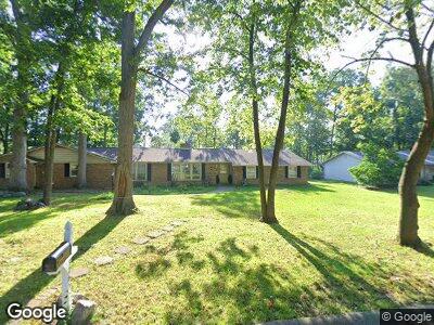
5205 Wapiti Dr Fort Wayne, IN 46804
Southwest Fort Wayne NeighborhoodEstimated Value: $317,000 - $337,000
4
Beds
3
Baths
2,380
Sq Ft
$136/Sq Ft
Est. Value
About This Home
This home is located at 5205 Wapiti Dr, Fort Wayne, IN 46804 and is currently estimated at $324,116, approximately $136 per square foot. 5205 Wapiti Dr is a home located in Allen County with nearby schools including Haverhill Elementary School, Summit Middle School, and Homestead Senior High School.
Ownership History
Date
Name
Owned For
Owner Type
Purchase Details
Closed on
Apr 15, 2020
Sold by
Stevens Walter J and Stevens Tracy M
Bought by
Stevens Walter J and Stevens Tracy Marie
Current Estimated Value
Home Financials for this Owner
Home Financials are based on the most recent Mortgage that was taken out on this home.
Original Mortgage
$178,000
Interest Rate
3.3%
Mortgage Type
VA
Purchase Details
Closed on
Jun 28, 2007
Sold by
Schmidt Robert F and Schmidt Carolyn I
Bought by
Stevens Walter J and Stevens Tracy M
Home Financials for this Owner
Home Financials are based on the most recent Mortgage that was taken out on this home.
Original Mortgage
$116,800
Interest Rate
6.37%
Mortgage Type
Purchase Money Mortgage
Create a Home Valuation Report for This Property
The Home Valuation Report is an in-depth analysis detailing your home's value as well as a comparison with similar homes in the area
Home Values in the Area
Average Home Value in this Area
Purchase History
| Date | Buyer | Sale Price | Title Company |
|---|---|---|---|
| Stevens Walter J | -- | Mortgage Connect Lp | |
| Stevens Walter J | -- | Lawyers Title |
Source: Public Records
Mortgage History
| Date | Status | Borrower | Loan Amount |
|---|---|---|---|
| Open | Stevens Walter J | $178,879 | |
| Closed | Stevens Walter J | $178,585 | |
| Closed | Stevens Walter J | $178,000 | |
| Closed | Stevens Walter J | $150,000 | |
| Closed | Stevens Walter J | $116,800 | |
| Closed | Stevens Walter J | $29,200 | |
| Previous Owner | Schmidt Robert F | $200,000 |
Source: Public Records
Tax History Compared to Growth
Tax History
| Year | Tax Paid | Tax Assessment Tax Assessment Total Assessment is a certain percentage of the fair market value that is determined by local assessors to be the total taxable value of land and additions on the property. | Land | Improvement |
|---|---|---|---|---|
| 2024 | $3,206 | $297,500 | $60,000 | $237,500 |
| 2022 | $2,635 | $244,500 | $30,600 | $213,900 |
| 2021 | $2,369 | $226,200 | $30,600 | $195,600 |
| 2020 | $2,020 | $192,800 | $30,600 | $162,200 |
| 2019 | $2,054 | $195,400 | $30,600 | $164,800 |
| 2018 | $2,005 | $190,500 | $30,600 | $159,900 |
| 2017 | $1,805 | $171,300 | $30,600 | $140,700 |
| 2016 | $1,668 | $157,700 | $30,600 | $127,100 |
| 2014 | $1,487 | $142,000 | $30,600 | $111,400 |
| 2013 | $1,468 | $139,600 | $30,600 | $109,000 |
Source: Public Records
Map
Nearby Homes
- 5326 Moonrock Ct
- 10412 Antelope Ct
- 9829 Echo Hill Dr
- 5220 Spartan Dr
- 9823 Houndshill Place
- 9818 Houndshill Place
- 5523 Cresthill Dr
- 4226 Turf Ln
- 5104 Binford Ln
- 9230 Liberty Mills Rd
- 5813 Rosedale Dr
- 4830 Winterfield Run
- 9520 Aboite Center Rd
- 9204 Barbara Ln
- 5234 Coventry Ln
- 5242 Coventry Ln
- 10425 Lake Tahoe Dr
- 10115 Lake Tahoe Ct
- 9323 Manor Woods Rd
- 3717 Live Oak Blvd
