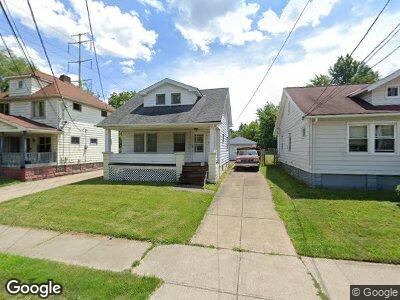
5299 Kohout St Maple Heights, OH 44137
Estimated Value: $106,000 - $111,000
2
Beds
1
Bath
1,080
Sq Ft
$101/Sq Ft
Est. Value
About This Home
This home is located at 5299 Kohout St, Maple Heights, OH 44137 and is currently estimated at $108,591, approximately $100 per square foot. 5299 Kohout St is a home located in Cuyahoga County with nearby schools including Abraham Lincoln Elementary School, Rockside/ J.F. Kennedy School, and Barack Obama School.
Ownership History
Date
Name
Owned For
Owner Type
Purchase Details
Closed on
Jun 25, 2010
Sold by
Bryant Jenise S
Bought by
Varga Csaba
Current Estimated Value
Purchase Details
Closed on
Jun 21, 2001
Sold by
Lutz Dale
Bought by
Bryant Jenise S
Home Financials for this Owner
Home Financials are based on the most recent Mortgage that was taken out on this home.
Original Mortgage
$76,393
Interest Rate
7.2%
Mortgage Type
FHA
Purchase Details
Closed on
May 12, 1987
Sold by
Julia Risko
Bought by
Risko Julia M
Purchase Details
Closed on
Feb 16, 1979
Sold by
Risko Joseph and Risko Julia
Bought by
Joseph and Julia Risko
Purchase Details
Closed on
Jan 1, 1975
Bought by
Risko Joseph and Risko Julia
Create a Home Valuation Report for This Property
The Home Valuation Report is an in-depth analysis detailing your home's value as well as a comparison with similar homes in the area
Home Values in the Area
Average Home Value in this Area
Purchase History
| Date | Buyer | Sale Price | Title Company |
|---|---|---|---|
| Varga Csaba | $9,460 | Public | |
| Bryant Jenise S | $77,000 | Executive Title Agency Corp | |
| Risko Julia M | -- | -- | |
| Joseph | -- | -- | |
| Risko Joseph | -- | -- |
Source: Public Records
Mortgage History
| Date | Status | Borrower | Loan Amount |
|---|---|---|---|
| Previous Owner | Bryant Jenise S | $77,538 | |
| Previous Owner | Bryant Jenise S | $76,393 |
Source: Public Records
Tax History Compared to Growth
Tax History
| Year | Tax Paid | Tax Assessment Tax Assessment Total Assessment is a certain percentage of the fair market value that is determined by local assessors to be the total taxable value of land and additions on the property. | Land | Improvement |
|---|---|---|---|---|
| 2024 | $3,070 | $32,970 | $7,455 | $25,515 |
| 2023 | $2,369 | $21,630 | $3,990 | $17,640 |
| 2022 | $2,361 | $21,630 | $3,990 | $17,640 |
| 2021 | $2,518 | $21,630 | $3,990 | $17,640 |
| 2020 | $2,150 | $16,380 | $3,010 | $13,370 |
| 2019 | $2,140 | $46,800 | $8,600 | $38,200 |
| 2018 | $2,128 | $16,380 | $3,010 | $13,370 |
| 2017 | $2,294 | $17,510 | $3,820 | $13,690 |
| 2016 | $2,220 | $17,510 | $3,820 | $13,690 |
| 2015 | $2,106 | $17,510 | $3,820 | $13,690 |
| 2014 | $2,106 | $18,030 | $3,920 | $14,110 |
Source: Public Records
Map
Nearby Homes
- 14703 Granger Rd
- 15300 Broadway Ave
- 5193 Miller Ave
- 5190 Milo Ave
- 13909 Wolf Ave
- 13608 Royal Blvd
- 5515 Dunham Rd
- 14405 Corridon Ave
- 13601 Granger Rd
- 16000 Maple Heights Blvd Unit 201
- 16080 Maple Heights Blvd Unit 202
- 14205 Corridon Ave
- 13621 Oak Park Blvd
- 14501 Kennerdown Ave
- 15605 Benhoff Dr
- 14206 Reddington Ave
- 14818 Kennerdown Ave
- 15705 Benhoff Dr
- 14504 Kennerdown Ave
- 15705 Fernway Dr