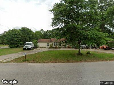
5328 Catherine Dr Satsuma, AL 36572
Satsuma NeighborhoodEstimated Value: $111,000 - $169,000
4
Beds
2
Baths
1,501
Sq Ft
$94/Sq Ft
Est. Value
About This Home
This home is located at 5328 Catherine Dr, Satsuma, AL 36572 and is currently estimated at $140,553, approximately $93 per square foot. 5328 Catherine Dr is a home located in Mobile County with nearby schools including Robert E. Lee Elementary School, Satsuma High School, and Satsuma Christian School.
Ownership History
Date
Name
Owned For
Owner Type
Purchase Details
Closed on
Feb 7, 2025
Sold by
West Jennifer and Proulx Jennifer
Bought by
West Jennifer
Current Estimated Value
Purchase Details
Closed on
Mar 27, 2007
Sold by
Parker Charles T and Parker Amogene B
Bought by
Dantzler Yvette Renee
Purchase Details
Closed on
Mar 15, 2007
Sold by
Proulx Ben Allen
Bought by
Proulx Jennifer
Purchase Details
Closed on
Aug 13, 2004
Sold by
Burton J Roe
Bought by
Proulx Ben A and Proulx Jennifer L
Home Financials for this Owner
Home Financials are based on the most recent Mortgage that was taken out on this home.
Original Mortgage
$62,000
Interest Rate
5.97%
Mortgage Type
New Conventional
Purchase Details
Closed on
Apr 17, 2004
Sold by
Bankston Gloria
Bought by
Burton J Roe
Create a Home Valuation Report for This Property
The Home Valuation Report is an in-depth analysis detailing your home's value as well as a comparison with similar homes in the area
Home Values in the Area
Average Home Value in this Area
Purchase History
| Date | Buyer | Sale Price | Title Company |
|---|---|---|---|
| West Jennifer | $500 | None Listed On Document | |
| Dantzler Yvette Renee | -- | None Available | |
| Proulx Jennifer | -- | None Available | |
| Proulx Ben A | -- | Surety Land Title Inc | |
| Burton J Roe | -- | -- |
Source: Public Records
Mortgage History
| Date | Status | Borrower | Loan Amount |
|---|---|---|---|
| Previous Owner | West Jennifer | $79,111 | |
| Previous Owner | Proulx Ben A | $62,000 | |
| Previous Owner | Bankston Gloria | $50,000 | |
| Closed | Proulx Ben A | $15,500 |
Source: Public Records
Tax History Compared to Growth
Tax History
| Year | Tax Paid | Tax Assessment Tax Assessment Total Assessment is a certain percentage of the fair market value that is determined by local assessors to be the total taxable value of land and additions on the property. | Land | Improvement |
|---|---|---|---|---|
| 2024 | $598 | $10,880 | $3,000 | $7,880 |
| 2023 | $598 | $9,930 | $2,500 | $7,430 |
| 2022 | $505 | $9,380 | $2,520 | $6,860 |
| 2021 | $461 | $8,640 | $2,520 | $6,120 |
| 2020 | $442 | $8,320 | $2,520 | $5,800 |
| 2019 | $404 | $7,720 | $0 | $0 |
| 2018 | $404 | $7,720 | $0 | $0 |
| 2017 | $404 | $7,720 | $0 | $0 |
| 2016 | $432 | $8,180 | $0 | $0 |
| 2013 | $432 | $8,020 | $0 | $0 |
Source: Public Records
Map
Nearby Homes
- 100 Williams Ave
- 0 Willie Crook Ave
- 53 Hilltop St
- 63 B E Orange Ave
- 5303 U S 43
- 5503 Darring St
- 311 Magnolia Ave Unit 65
- 311 Magnolia Ave Unit 44
- 311 Magnolia Ave Unit 64
- 311 Magnolia Ave Unit 33
- 5618 3rd St
- 0 U S 43
- 5556 7th St
- 5665 Hi Wood Ct
- 0 Travelers Ct Unit 34 315632
- 211 Magnolia Ave
- 0 Baldwin St
- 0 Old Us Highway 43 Unit 225113
- 168a Juniper Ave
- 5620 Orchard St