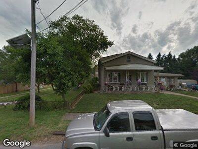
535 Roosevelt Ave Glendora, NJ 08029
Glendora NeighborhoodEstimated Value: $237,901 - $292,000
2
Beds
1
Bath
840
Sq Ft
$315/Sq Ft
Est. Value
About This Home
This home is located at 535 Roosevelt Ave, Glendora, NJ 08029 and is currently estimated at $264,225, approximately $314 per square foot. 535 Roosevelt Ave is a home located in Camden County with nearby schools including Triton High School and St. Teresa Regional School.
Ownership History
Date
Name
Owned For
Owner Type
Purchase Details
Closed on
Nov 25, 2009
Sold by
Francois Ronald
Bought by
Cabet Properties Llc
Current Estimated Value
Purchase Details
Closed on
Jul 1, 2005
Sold by
Weiss Laura
Bought by
Francois Ronald
Home Financials for this Owner
Home Financials are based on the most recent Mortgage that was taken out on this home.
Original Mortgage
$88,000
Interest Rate
5.59%
Create a Home Valuation Report for This Property
The Home Valuation Report is an in-depth analysis detailing your home's value as well as a comparison with similar homes in the area
Home Values in the Area
Average Home Value in this Area
Purchase History
| Date | Buyer | Sale Price | Title Company |
|---|---|---|---|
| Cabet Properties Llc | $85,000 | -- | |
| Francois Ronald | $110,000 | -- |
Source: Public Records
Mortgage History
| Date | Status | Borrower | Loan Amount |
|---|---|---|---|
| Previous Owner | Francois Ronald | $88,000 |
Source: Public Records
Tax History Compared to Growth
Tax History
| Year | Tax Paid | Tax Assessment Tax Assessment Total Assessment is a certain percentage of the fair market value that is determined by local assessors to be the total taxable value of land and additions on the property. | Land | Improvement |
|---|---|---|---|---|
| 2024 | $5,368 | $131,400 | $49,900 | $81,500 |
| 2023 | $5,368 | $131,400 | $49,900 | $81,500 |
| 2022 | $5,339 | $131,400 | $49,900 | $81,500 |
| 2021 | $5,227 | $131,400 | $49,900 | $81,500 |
| 2020 | $5,231 | $131,400 | $49,900 | $81,500 |
| 2019 | $5,115 | $131,400 | $49,900 | $81,500 |
| 2018 | $5,093 | $131,400 | $49,900 | $81,500 |
| 2017 | $5,934 | $131,400 | $49,900 | $81,500 |
| 2016 | $4,820 | $131,400 | $49,900 | $81,500 |
| 2015 | $4,474 | $131,400 | $49,900 | $81,500 |
| 2014 | $4,448 | $131,400 | $49,900 | $81,500 |
Source: Public Records
Map
Nearby Homes
- 518 Rowand Ave
- 701 Station Ave
- 419 Ridge Ave
- 508 Woodland Ave
- 501 W Evesham Rd
- 305 Station Ave
- 408 Melvin Ave
- 818 Price Ave
- 218 High St
- 116 Station Ave
- 112 Bozarth Ave
- 190 High St
- 1016 Huntington Ave
- 231 W Evesham Rd
- 2 Front St
- 219 Chestnut St
- 111 E Front St
- 21 S Oakland Ave
- 200 E 9th Ave
- 429 W 1st Ave