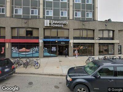
536 S Forest Ave Ann Arbor, MI 48104
Downtown Ann Arbor Neighborhood
--
Bed
--
Bath
--
Sq Ft
0.52
Acres
About This Home
This home is located at 536 S Forest Ave, Ann Arbor, MI 48104. 536 S Forest Ave is a home located in Washtenaw County with nearby schools including Burns Park Elementary School, Tappan Middle School, and Pioneer High School.
Ownership History
Date
Name
Owned For
Owner Type
Purchase Details
Closed on
Feb 15, 2006
Sold by
University Towers Llc
Bought by
University Towers Llc
Home Financials for this Owner
Home Financials are based on the most recent Mortgage that was taken out on this home.
Original Mortgage
$31,500,000
Interest Rate
6.2%
Mortgage Type
Commercial
Create a Home Valuation Report for This Property
The Home Valuation Report is an in-depth analysis detailing your home's value as well as a comparison with similar homes in the area
Home Values in the Area
Average Home Value in this Area
Purchase History
| Date | Buyer | Sale Price | Title Company |
|---|---|---|---|
| University Towers Llc | -- | Liberty Title |
Source: Public Records
Mortgage History
| Date | Status | Borrower | Loan Amount |
|---|---|---|---|
| Open | University Towers Llc | $35,000,000 | |
| Closed | University Towers Llc | $31,500,000 |
Source: Public Records
Tax History Compared to Growth
Tax History
| Year | Tax Paid | Tax Assessment Tax Assessment Total Assessment is a certain percentage of the fair market value that is determined by local assessors to be the total taxable value of land and additions on the property. | Land | Improvement |
|---|---|---|---|---|
| 2024 | $432,093 | $33,971,700 | $0 | $0 |
| 2023 | $398,990 | $33,403,600 | $0 | $0 |
| 2022 | $482,905 | $33,461,700 | $0 | $0 |
| 2021 | $469,265 | $31,796,600 | $0 | $0 |
| 2020 | $454,495 | $27,846,900 | $0 | $0 |
| 2019 | $433,523 | $27,190,300 | $27,190,300 | $0 |
| 2018 | $425,335 | $23,555,900 | $0 | $0 |
| 2017 | $410,314 | $21,554,200 | $0 | $0 |
| 2016 | $400,085 | $6,461,509 | $0 | $0 |
| 2015 | $380,260 | $6,442,183 | $0 | $0 |
| 2014 | $380,260 | $6,085,099 | $0 | $0 |
| 2013 | -- | $6,085,099 | $0 | $0 |
Source: Public Records
Map
Nearby Homes
- 509 Linden St
- 929 Olivia Ave
- 1015 Olivia Ave
- 805 Oxford Rd
- 555 E William St Unit 19F
- 555 E William St Unit 16K
- 555 E William St Unit 12i
- 555 E William St Unit 19C
- 555 E William St Unit 4A
- 555 E William St Unit 14C
- 555 E William St Unit 12L
- 555 E William St Unit 23A
- 928 Catherine St
- 912 Mary St
- 922 Catherine St
- 1219 S Forest Ave
- 322 E Liberty St Unit 16 & 17
- 330 Detroit St Unit 101
- 330 Detroit St Unit 303
- 330 Detroit St Unit 401