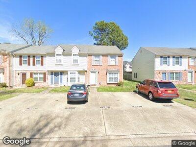
542 Hollomon Dr Hampton, VA 23666
Northampton NeighborhoodEstimated Value: $222,000 - $236,000
3
Beds
3
Baths
1,385
Sq Ft
$167/Sq Ft
Est. Value
About This Home
This home is located at 542 Hollomon Dr, Hampton, VA 23666 and is currently estimated at $230,641, approximately $166 per square foot. 542 Hollomon Dr is a home located in Hampton City with nearby schools including Christopher C. Kraft Elementary School, Cesar Tarrant Middle School, and Bethel High School.
Ownership History
Date
Name
Owned For
Owner Type
Purchase Details
Closed on
Nov 8, 1999
Sold by
Stacey William H
Bought by
Savage Evelyn P
Current Estimated Value
Home Financials for this Owner
Home Financials are based on the most recent Mortgage that was taken out on this home.
Original Mortgage
$73,350
Interest Rate
7.73%
Create a Home Valuation Report for This Property
The Home Valuation Report is an in-depth analysis detailing your home's value as well as a comparison with similar homes in the area
Home Values in the Area
Average Home Value in this Area
Purchase History
| Date | Buyer | Sale Price | Title Company |
|---|---|---|---|
| Savage Evelyn P | $74,000 | -- |
Source: Public Records
Mortgage History
| Date | Status | Borrower | Loan Amount |
|---|---|---|---|
| Open | Rivera Evelyn P | $16,183 | |
| Open | Picott Evelyn P | $155,244 | |
| Closed | Picott Evelyn P | $124,280 | |
| Closed | Picott Evelyn R | $109,650 | |
| Closed | Savage Evelyn P | $73,350 |
Source: Public Records
Tax History Compared to Growth
Tax History
| Year | Tax Paid | Tax Assessment Tax Assessment Total Assessment is a certain percentage of the fair market value that is determined by local assessors to be the total taxable value of land and additions on the property. | Land | Improvement |
|---|---|---|---|---|
| 2024 | $2,401 | $208,800 | $45,000 | $163,800 |
| 2023 | $1,969 | $169,700 | $45,000 | $124,700 |
| 2022 | $1,902 | $161,200 | $38,000 | $123,200 |
| 2021 | $1,748 | $130,500 | $31,000 | $99,500 |
| 2020 | $1,590 | $128,200 | $31,000 | $97,200 |
| 2019 | $1,580 | $127,400 | $31,000 | $96,400 |
| 2018 | $1,690 | $128,700 | $32,300 | $96,400 |
| 2017 | $1,690 | $0 | $0 | $0 |
| 2016 | $1,690 | $128,700 | $0 | $0 |
| 2015 | $1,690 | $0 | $0 | $0 |
| 2014 | $1,757 | $128,700 | $32,300 | $96,400 |
Source: Public Records
Map
Nearby Homes
- 35 Lyford Key Unit A
- 9 Emeraude Plage
- 204 Florence Dr
- 202 Florence Dr
- 610 Big Bethel Rd
- 2801 Bending Oak Dr
- 3317 Greenwood Dr
- 710 Big Bethel Rd
- 24 Hickory Hill Rd
- 33 Woodbury Forrest Dr
- 1600 Todds Ln
- 3204 W Weaver Rd
- 4 Greenwood Dr
- 111 Aspenwood Dr
- 4005 W Weaver Rd
- 461 Joy Dr
- 116 Twin Oaks Dr
- 104 Horsley Dr
- 127 Springdale Way
- 12 W Walker Rd