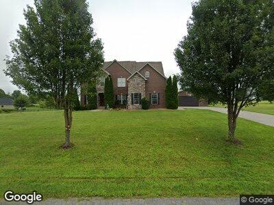
549 Sara Ln London, KY 40741
Estimated Value: $505,791 - $581,000
5
Beds
3
Baths
3,500
Sq Ft
$157/Sq Ft
Est. Value
About This Home
This home is located at 549 Sara Ln, London, KY 40741 and is currently estimated at $550,698, approximately $157 per square foot. 549 Sara Ln is a home located in Laurel County.
Ownership History
Date
Name
Owned For
Owner Type
Purchase Details
Closed on
Jun 4, 2024
Sold by
Wornstaff Nancy M and Wornstaff Terry W
Bought by
Hensley James J and Hensley Jessica Ann
Current Estimated Value
Home Financials for this Owner
Home Financials are based on the most recent Mortgage that was taken out on this home.
Original Mortgage
$416,000
Outstanding Balance
$413,227
Interest Rate
7.02%
Mortgage Type
New Conventional
Estimated Equity
$137,471
Purchase Details
Closed on
Jan 25, 2022
Sold by
Rollin and Dianna
Bought by
Wornstaff Nancy M and Wornstaff Terry W
Purchase Details
Closed on
Apr 24, 2019
Sold by
Bargo Michael and Bargo Tara
Bought by
Hollin David and Hollin Dianna
Create a Home Valuation Report for This Property
The Home Valuation Report is an in-depth analysis detailing your home's value as well as a comparison with similar homes in the area
Home Values in the Area
Average Home Value in this Area
Purchase History
| Date | Buyer | Sale Price | Title Company |
|---|---|---|---|
| Hensley James J | $520,000 | Indecomm Global Services | |
| Wornstaff Nancy M | $465,000 | New Title Company Name | |
| Hollin David | $315,000 | Kentucky Mtn Land Title |
Source: Public Records
Mortgage History
| Date | Status | Borrower | Loan Amount |
|---|---|---|---|
| Open | Hensley James J | $416,000 |
Source: Public Records
Tax History Compared to Growth
Tax History
| Year | Tax Paid | Tax Assessment Tax Assessment Total Assessment is a certain percentage of the fair market value that is determined by local assessors to be the total taxable value of land and additions on the property. | Land | Improvement |
|---|---|---|---|---|
| 2024 | $3,585 | $465,000 | $0 | $0 |
| 2023 | $3,678 | $465,000 | $0 | $0 |
| 2022 | $3,701 | $465,000 | $0 | $0 |
| 2021 | $2,599 | $315,000 | $0 | $0 |
| 2020 | $2,612 | $315,000 | $0 | $0 |
| 2019 | $2,501 | $300,000 | $0 | $0 |
| 2018 | $2,280 | $274,000 | $0 | $0 |
| 2017 | $2,279 | $274,000 | $0 | $0 |
| 2015 | $2,271 | $274,000 | $32,000 | $242,000 |
| 2012 | $2,197 | $274,000 | $32,000 | $242,000 |
Source: Public Records
Map
Nearby Homes
- 1001 Afton Ln
- 245 Cedar Point Dr
- 330 Arden Dr
- 296 Arden Dr
- 36 & 37 Ridgeline Dr
- 47 Ridgeline Dr
- 28 Cliff Line Dr
- 27 Cliff Line Dr
- 26 Cliff Line Dr
- 25 Cliff Line Dr
- 46 Ridgeline Dr
- 24 Cliff Line Dr
- 293 Cold Hill Rd
- 23 Deep Wood Dr
- 55 Green Cove Dr
- 56 Green Cove Dr
- 57 Green Cove Dr
- 58 Green Cove Dr
- 4 Golden Pond Dr
- 5 Golden Pond Dr