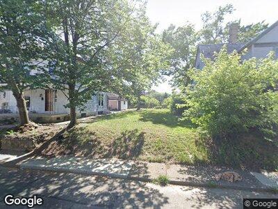
553 Brightwood Ave Dayton, OH 45405
Riverdale NeighborhoodEstimated Value: $37,000
3
Beds
2
Baths
1,400
Sq Ft
$26/Sq Ft
Est. Value
About This Home
This home is located at 553 Brightwood Ave, Dayton, OH 45405 and is currently priced at $37,000, approximately $26 per square foot. 553 Brightwood Ave is a home located in Montgomery County with nearby schools including International School at Residence Park, Louise Troy Elementary, and Westwood Elementary.
Ownership History
Date
Name
Owned For
Owner Type
Purchase Details
Closed on
Mar 2, 2022
Sold by
Montgomery County Land Reutilization Cor
Bought by
City Of Dayton
Current Estimated Value
Purchase Details
Closed on
Jul 21, 2017
Sold by
Cheshire Gregory D
Bought by
Montgomery County Land Reutilization Cor
Purchase Details
Closed on
May 2, 1996
Sold by
Cheshire Karen L
Bought by
Cheshire Gregory D
Create a Home Valuation Report for This Property
The Home Valuation Report is an in-depth analysis detailing your home's value as well as a comparison with similar homes in the area
Home Values in the Area
Average Home Value in this Area
Purchase History
| Date | Buyer | Sale Price | Title Company |
|---|---|---|---|
| City Of Dayton | -- | Costello Shannon L | |
| Montgomery County Land Reutilization Cor | -- | None Available | |
| Cheshire Gregory D | -- | -- |
Source: Public Records
Mortgage History
| Date | Status | Borrower | Loan Amount |
|---|---|---|---|
| Previous Owner | Montgomery County Land Reutilization Cor | $25,000 | |
| Previous Owner | Montgomery County Land Reutilization Cor | $0 |
Source: Public Records
Tax History Compared to Growth
Tax History
| Year | Tax Paid | Tax Assessment Tax Assessment Total Assessment is a certain percentage of the fair market value that is determined by local assessors to be the total taxable value of land and additions on the property. | Land | Improvement |
|---|---|---|---|---|
| 2024 | $1 | $2,360 | $2,360 | -- |
| 2023 | $1 | $2,360 | $2,360 | $0 |
| 2022 | $23 | $2,360 | $2,360 | $0 |
| 2021 | $23 | $2,360 | $2,360 | $0 |
| 2020 | $23 | $2,360 | $2,360 | $0 |
| 2019 | $39 | $2,360 | $2,360 | $0 |
| 2018 | $228 | $6,130 | $2,360 | $3,770 |
| 2017 | $39 | $6,130 | $2,360 | $3,770 |
| 2016 | $956 | $6,130 | $2,360 | $3,770 |
| 2015 | $1,315 | $6,130 | $2,360 | $3,770 |
| 2014 | $1,315 | $6,130 | $2,360 | $3,770 |
| 2012 | -- | $11,480 | $2,940 | $8,540 |
Source: Public Records
Map
Nearby Homes
- 1235 N Main St
- 20 5 Oaks Ave
- 200 Squirrel Rd
- 103 Warder St Unit 101
- 78 Vincent St
- 41 Locust St
- 810 Belmonte Park N
- 53 Locust St Unit 51
- 117 Elizabeth St
- 602 Rockford Ave
- 611 Rockford Ave
- 603 Rockford Ave
- 301 Kenilworth Ave
- 710 Rockford Ave Unit 704
- 42 Mary Ave
- 358 Kenwood Ave
- 244 Delaware Ave Unit 242
- 601 Riverside Dr
- 123 Delaware Ave
- 370 Kenwood Ave
