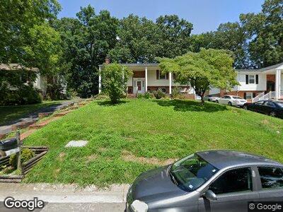
5539 Sweetfern Dr Roanoke, VA 24019
Estimated Value: $278,000 - $305,000
4
Beds
3
Baths
1,951
Sq Ft
$148/Sq Ft
Est. Value
About This Home
This home is located at 5539 Sweetfern Dr, Roanoke, VA 24019 and is currently estimated at $288,722, approximately $147 per square foot. 5539 Sweetfern Dr is a home located in Roanoke County with nearby schools including Glen Cove Elementary School, Northside Middle School, and Northside High School.
Ownership History
Date
Name
Owned For
Owner Type
Purchase Details
Closed on
Mar 16, 2012
Sold by
Cole Nancy H Speese and Speese Nancy H
Bought by
Cole Nancy H Speese and Cole Darrian K
Current Estimated Value
Home Financials for this Owner
Home Financials are based on the most recent Mortgage that was taken out on this home.
Original Mortgage
$134,128
Outstanding Balance
$93,830
Interest Rate
3.88%
Mortgage Type
FHA
Estimated Equity
$194,892
Create a Home Valuation Report for This Property
The Home Valuation Report is an in-depth analysis detailing your home's value as well as a comparison with similar homes in the area
Home Values in the Area
Average Home Value in this Area
Purchase History
| Date | Buyer | Sale Price | Title Company |
|---|---|---|---|
| Cole Nancy H Speese | -- | None Available |
Source: Public Records
Mortgage History
| Date | Status | Borrower | Loan Amount |
|---|---|---|---|
| Open | Cole Nancy H Speese | $134,128 |
Source: Public Records
Tax History Compared to Growth
Tax History
| Year | Tax Paid | Tax Assessment Tax Assessment Total Assessment is a certain percentage of the fair market value that is determined by local assessors to be the total taxable value of land and additions on the property. | Land | Improvement |
|---|---|---|---|---|
| 2024 | $2,440 | $234,600 | $56,000 | $178,600 |
| 2023 | $2,292 | $216,200 | $46,000 | $170,200 |
| 2022 | $1,943 | $178,300 | $36,000 | $142,300 |
| 2021 | $1,858 | $170,500 | $34,000 | $136,500 |
| 2020 | $1,784 | $163,700 | $34,000 | $129,700 |
| 2019 | $1,710 | $156,900 | $34,000 | $122,900 |
| 2018 | $1,648 | $152,400 | $32,000 | $120,400 |
| 2017 | $1,648 | $151,200 | $32,000 | $119,200 |
| 2016 | $1,600 | $146,800 | $32,000 | $114,800 |
| 2015 | $1,601 | $146,900 | $32,000 | $114,900 |
| 2014 | $1,602 | $147,000 | $32,000 | $115,000 |
Source: Public Records
Map
Nearby Homes
- 5112 Pin Oak Dr
- 5429 Taney Dr
- 8340 Brubaker Dr
- 5281 N Spring Dr
- 5241 N Spring Dr
- 8007 Amber Wood Ct
- 5022 Nicholas Hill Ln
- 2914 Diplomat Dr
- 0 Plain View Ave
- 5531 Ambassador Dr
- 5703 Green Ridge Rd
- 3509 Peters Creek Rd NW
- 3531 Peters Creek Rd NW Unit 201
- 3531 Peters Creek Rd NW Unit 302
- 2048 Laura Rd NW
- 3105 Embassy Dr
- 1941 Governor Dr
- 4433 Lewiston St NW
- 4774 Northwood Dr NW
- 4770 Northwood Dr NW