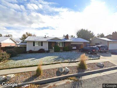
5557 Hugoton Dr Salt Lake City, UT 84129
Estimated Value: $480,000 - $519,000
4
Beds
2
Baths
2,030
Sq Ft
$248/Sq Ft
Est. Value
About This Home
This home is located at 5557 Hugoton Dr, Salt Lake City, UT 84129 and is currently estimated at $502,778, approximately $247 per square foot. 5557 Hugoton Dr is a home located in Salt Lake County with nearby schools including Vista Elementary School, Eisenhower Jr High School, and Taylorsville High School.
Ownership History
Date
Name
Owned For
Owner Type
Purchase Details
Closed on
May 5, 2023
Sold by
David And Glenna Alama Family Trust
Bought by
Spinks Scipio A and Spinks Karen Y
Current Estimated Value
Home Financials for this Owner
Home Financials are based on the most recent Mortgage that was taken out on this home.
Original Mortgage
$474,251
Outstanding Balance
$464,601
Interest Rate
6.42%
Mortgage Type
FHA
Estimated Equity
$38,177
Purchase Details
Closed on
Apr 4, 2002
Sold by
Alama David and Alama Glenna
Bought by
Alama David and Alama Glenna
Home Financials for this Owner
Home Financials are based on the most recent Mortgage that was taken out on this home.
Original Mortgage
$18,000
Interest Rate
6.78%
Create a Home Valuation Report for This Property
The Home Valuation Report is an in-depth analysis detailing your home's value as well as a comparison with similar homes in the area
Home Values in the Area
Average Home Value in this Area
Purchase History
| Date | Buyer | Sale Price | Title Company |
|---|---|---|---|
| Spinks Scipio A | -- | Backman Title | |
| Alama David | -- | Township Title | |
| Alama David | -- | Township Title |
Source: Public Records
Mortgage History
| Date | Status | Borrower | Loan Amount |
|---|---|---|---|
| Open | Spinks Scipio A | $474,251 | |
| Previous Owner | Alama David | $30,000 | |
| Previous Owner | Alama David | $18,000 |
Source: Public Records
Tax History Compared to Growth
Tax History
| Year | Tax Paid | Tax Assessment Tax Assessment Total Assessment is a certain percentage of the fair market value that is determined by local assessors to be the total taxable value of land and additions on the property. | Land | Improvement |
|---|---|---|---|---|
| 2023 | $2,745 | $441,500 | $142,700 | $298,800 |
| 2022 | $139 | $451,900 | $139,900 | $312,000 |
| 2021 | $214 | $371,100 | $107,600 | $263,500 |
| 2020 | $2,415 | $323,000 | $89,000 | $234,000 |
| 2019 | $154 | $310,700 | $64,500 | $246,200 |
| 2018 | $0 | $281,700 | $64,500 | $217,200 |
| 2017 | $198 | $257,300 | $60,600 | $196,700 |
| 2016 | $193 | $231,600 | $52,700 | $178,900 |
| 2015 | $1,210 | $195,400 | $50,900 | $144,500 |
| 2014 | $208 | $188,000 | $49,300 | $138,700 |
Source: Public Records
Map
Nearby Homes
- 5552 Hew Wood Dr
- 2049 W 5310 S
- 1986 W 5315 S
- 5275 S Samuel Cir
- 2410 W Sharron Dr
- 1993 Farm Ridge Rd
- 1923 W Leisure Cir
- 2540 W 5860 S
- 5884 Surrey Rd
- 5785 S Ferron Cir
- 2794 W Harker Ridge Cove
- 2637 Builders Dr
- 5336 Beacon Hill Cir
- 5338 S Beacon Hill Cir Unit 181
- 5632 S Ferron Dr
- 2587 W Central Park Cir
- 1418 W Telegraph Hill Dr
- 1464 W Duck Pond Ln
- 2590 W Central Park Cir
- 6129 S Clara Dr