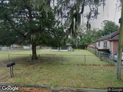
559 Lawton Ave Jacksonville, FL 32208
Panama Park NeighborhoodEstimated Value: $149,000 - $173,000
3
Beds
2
Baths
1,152
Sq Ft
$140/Sq Ft
Est. Value
About This Home
This home is located at 559 Lawton Ave, Jacksonville, FL 32208 and is currently estimated at $160,883, approximately $139 per square foot. 559 Lawton Ave is a home located in Duval County with nearby schools including North Shore Elementary School, Matthew W. Gilbert Middle School, and Jean Ribault High School.
Ownership History
Date
Name
Owned For
Owner Type
Purchase Details
Closed on
Jul 13, 2001
Sold by
Mosley Robert G and Mosley Frances C
Bought by
Banks Cornelious and Banks Janie M
Current Estimated Value
Home Financials for this Owner
Home Financials are based on the most recent Mortgage that was taken out on this home.
Original Mortgage
$50,242
Outstanding Balance
$21,135
Interest Rate
7.16%
Mortgage Type
FHA
Estimated Equity
$146,982
Purchase Details
Closed on
Jun 18, 1999
Sold by
Reid Percy V
Bought by
Mosley Robert G and Mosley Frances C
Create a Home Valuation Report for This Property
The Home Valuation Report is an in-depth analysis detailing your home's value as well as a comparison with similar homes in the area
Home Values in the Area
Average Home Value in this Area
Purchase History
| Date | Buyer | Sale Price | Title Company |
|---|---|---|---|
| Banks Cornelious | $71,500 | -- | |
| Mosley Robert G | $9,000 | -- |
Source: Public Records
Mortgage History
| Date | Status | Borrower | Loan Amount |
|---|---|---|---|
| Open | Banks Cornelious | $50,242 |
Source: Public Records
Tax History Compared to Growth
Tax History
| Year | Tax Paid | Tax Assessment Tax Assessment Total Assessment is a certain percentage of the fair market value that is determined by local assessors to be the total taxable value of land and additions on the property. | Land | Improvement |
|---|---|---|---|---|
| 2024 | $2,630 | $136,061 | $26,780 | $109,281 |
| 2023 | $2,630 | $136,369 | $26,780 | $109,589 |
| 2022 | $2,143 | $115,187 | $20,600 | $94,587 |
| 2021 | $598 | $48,805 | $0 | $0 |
| 2020 | $589 | $48,132 | $0 | $0 |
| 2019 | $576 | $47,050 | $0 | $0 |
| 2018 | $563 | $46,173 | $0 | $0 |
| 2017 | $551 | $45,224 | $0 | $0 |
| 2016 | $540 | $44,294 | $0 | $0 |
| 2015 | $541 | $43,987 | $0 | $0 |
| 2014 | $538 | $43,638 | $0 | $0 |
Source: Public Records
Map
Nearby Homes
- 8020 Tamarack St
- 8027 Floyd St
- 8056 Floyd St
- 7435 Bloxham Ave
- 8038 Bond Dr
- 636 Lawton Ave
- 8073 Wakefield Ave
- 622 E 63rd St
- 314 E 65th St
- 708 Virginia St
- 717 Virginia St
- 430 Trout River Dr
- 535 E 61st St
- 607 E 60th St
- 578 E 60th St
- 558 E 60th St
- 904 Virginia St
- 75 E 61st St
- 7449 Laura St N
- 7437 Laura St N