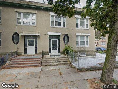
56 Ashford St Allston, MA 02134
Allston NeighborhoodEstimated Value: $1,031,048 - $1,146,000
2
Beds
3
Baths
999
Sq Ft
$1,085/Sq Ft
Est. Value
About This Home
This home is located at 56 Ashford St, Allston, MA 02134 and is currently estimated at $1,084,012, approximately $1,085 per square foot. 56 Ashford St is a home located in Suffolk County with nearby schools including Match Charter Public School, St Herman Of Alaska Christian School, and Boston University Academy.
Ownership History
Date
Name
Owned For
Owner Type
Purchase Details
Closed on
Aug 11, 2011
Sold by
56 Ashford Street Rt
Bought by
Oconnor William and Oconnor Huina X
Current Estimated Value
Home Financials for this Owner
Home Financials are based on the most recent Mortgage that was taken out on this home.
Original Mortgage
$351,200
Outstanding Balance
$246,788
Interest Rate
4.51%
Mortgage Type
Purchase Money Mortgage
Estimated Equity
$837,224
Purchase Details
Closed on
May 11, 2007
Sold by
Tam Suk S
Bought by
56 Ashford Street Rt
Create a Home Valuation Report for This Property
The Home Valuation Report is an in-depth analysis detailing your home's value as well as a comparison with similar homes in the area
Home Values in the Area
Average Home Value in this Area
Purchase History
| Date | Buyer | Sale Price | Title Company |
|---|---|---|---|
| Oconnor William | $439,000 | -- | |
| 56 Ashford Street Rt | -- | -- |
Source: Public Records
Mortgage History
| Date | Status | Borrower | Loan Amount |
|---|---|---|---|
| Open | Oconnor William | $351,200 | |
| Previous Owner | Tam Suk S | $80,000 |
Source: Public Records
Property History
| Date | Event | Price | Change | Sq Ft Price |
|---|---|---|---|---|
| 02/10/2025 02/10/25 | Off Market | -- | -- | -- |
| 02/10/2025 02/10/25 | Off Market | -- | -- | -- |
| 01/15/2025 01/15/25 | For Rent | -- | -- | -- |
| 01/10/2025 01/10/25 | For Rent | -- | -- | -- |
Tax History Compared to Growth
Tax History
| Year | Tax Paid | Tax Assessment Tax Assessment Total Assessment is a certain percentage of the fair market value that is determined by local assessors to be the total taxable value of land and additions on the property. | Land | Improvement |
|---|---|---|---|---|
| 2025 | $9,829 | $848,800 | $275,600 | $573,200 |
| 2024 | $9,187 | $842,800 | $298,400 | $544,400 |
| 2023 | $9,052 | $842,800 | $298,400 | $544,400 |
| 2022 | $8,904 | $818,400 | $289,800 | $528,600 |
| 2021 | $8,197 | $768,200 | $278,600 | $489,600 |
| 2020 | $7,142 | $676,300 | $217,600 | $458,700 |
| 2019 | $6,789 | $644,100 | $186,300 | $457,800 |
| 2018 | $6,492 | $619,500 | $186,300 | $433,200 |
| 2017 | $6,432 | $607,400 | $186,300 | $421,100 |
| 2016 | $6,304 | $573,100 | $186,300 | $386,800 |
| 2015 | $5,711 | $471,600 | $148,600 | $323,000 |
| 2014 | $5,330 | $423,700 | $150,500 | $273,200 |
Source: Public Records
Map
Nearby Homes
- 52 Ashford St
- 59 Brighton Ave Unit 1
- 57 Brighton Ave Unit C
- 57 Brighton Ave Unit B
- 57 Brighton Ave Unit D
- 40 Chester St Unit B
- 30 Massachusetts 30 Unit 3
- 11-13 Mansfield St Unit 2
- 30 Reedsdale St Unit 5
- 32 Reedsdale St Unit B
- 100 Linden St Unit 4
- 202 Fuller St Unit 2
- 31 Haskell St
- 10 Windom St
- 4 Franklin St Unit 401
- 4 Franklin St Unit 302
- 4 Franklin St Unit 303
- 4 Franklin St Unit 203
- 4 Franklin St Unit 402
- 4 Franklin St Unit 403