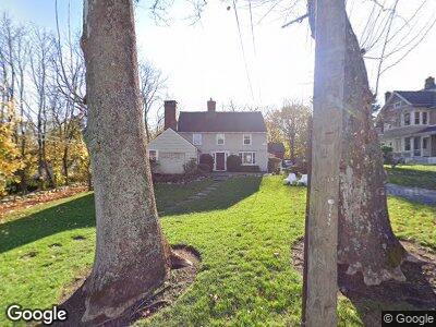
57 Wright St Westport, CT 06880
Old Hill NeighborhoodEstimated Value: $1,598,000 - $1,843,000
3
Beds
3
Baths
2,145
Sq Ft
$807/Sq Ft
Est. Value
About This Home
This home is located at 57 Wright St, Westport, CT 06880 and is currently estimated at $1,731,549, approximately $807 per square foot. 57 Wright St is a home located in Fairfield County with nearby schools including King's Highway Elementary School, Coleytown Middle School, and Staples High School.
Ownership History
Date
Name
Owned For
Owner Type
Purchase Details
Closed on
Jun 29, 2020
Sold by
Glaser Cheryl and Glaser Scott
Bought by
Engel Andreas and Engel Sarah
Current Estimated Value
Purchase Details
Closed on
Aug 9, 2013
Sold by
Glaser Cheryl
Bought by
Glaser Cheryl and Glaser Scott
Purchase Details
Closed on
May 9, 2011
Sold by
Glaser Scott
Bought by
Glaser Cheryl
Purchase Details
Closed on
Nov 15, 2010
Sold by
Obrien Tess M
Bought by
Glaser Scott and Glaser Cheryl
Home Financials for this Owner
Home Financials are based on the most recent Mortgage that was taken out on this home.
Original Mortgage
$492,000
Interest Rate
4.35%
Create a Home Valuation Report for This Property
The Home Valuation Report is an in-depth analysis detailing your home's value as well as a comparison with similar homes in the area
Home Values in the Area
Average Home Value in this Area
Purchase History
| Date | Buyer | Sale Price | Title Company |
|---|---|---|---|
| Engel Andreas | $1,125,000 | None Available | |
| Engel Andreas | $1,125,000 | None Available | |
| Glaser Cheryl | -- | -- | |
| Glaser Cheryl | -- | -- | |
| Glaser Cheryl | -- | -- | |
| Glaser Cheryl | -- | -- | |
| Glaser Scott | $820,000 | -- | |
| Glaser Scott | $820,000 | -- |
Source: Public Records
Mortgage History
| Date | Status | Borrower | Loan Amount |
|---|---|---|---|
| Open | Engel Andreas | $1,021,950 | |
| Previous Owner | Glaser Cheryl | $491,000 | |
| Previous Owner | Knofla Leroy | $492,000 |
Source: Public Records
Tax History Compared to Growth
Tax History
| Year | Tax Paid | Tax Assessment Tax Assessment Total Assessment is a certain percentage of the fair market value that is determined by local assessors to be the total taxable value of land and additions on the property. | Land | Improvement |
|---|---|---|---|---|
| 2024 | $12,408 | $666,400 | $353,400 | $313,000 |
| 2023 | $12,205 | $665,100 | $353,400 | $311,700 |
| 2022 | $12,018 | $665,100 | $353,400 | $311,700 |
| 2021 | $12,018 | $665,100 | $353,400 | $311,700 |
| 2020 | $10,504 | $690,400 | $324,700 | $365,700 |
| 2019 | $11,640 | $690,400 | $324,700 | $365,700 |
| 2018 | $11,640 | $690,400 | $324,700 | $365,700 |
| 2017 | $11,640 | $690,400 | $324,700 | $365,700 |
| 2016 | $11,640 | $690,400 | $324,700 | $365,700 |
| 2015 | $9,608 | $531,100 | $264,700 | $266,400 |
| 2014 | $9,528 | $531,100 | $264,700 | $266,400 |
Source: Public Records
Map
Nearby Homes
- 60 Wilton Rd Unit 2C
- 31 Lincoln St
- 19 Old Hill Farms Rd
- 4 Pequot Trail
- 9 Harborview Rd
- 53 Sylvan Rd N
- 3 Tanglewood Ln
- 29 Otter Trail
- 5 Carlisle Ct
- 22 Oak Ridge Park
- 3 Laurel Ln
- 1 Pine St
- 57 Evergreen Ave
- 378 Riverside Ave
- 127 Compo Rd S
- 15 Lone Pine Ln
- 387 Main St
- 41 Richmondville Ave Unit 311
- 41 Richmondville Ave Unit Duplex 2
- 41 Richmondville Ave Unit 214