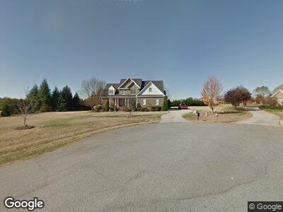
5703 Cape Fox Dr Oak Ridge, NC 27310
Oak Ridge NeighborhoodEstimated Value: $714,895 - $845,000
4
Beds
4
Baths
3,673
Sq Ft
$219/Sq Ft
Est. Value
About This Home
This home is located at 5703 Cape Fox Dr, Oak Ridge, NC 27310 and is currently estimated at $803,474, approximately $218 per square foot. 5703 Cape Fox Dr is a home located in Guilford County with nearby schools including Oak Ridge Elementary School, Northwest Guilford Middle School, and Northwest Guilford High School.
Ownership History
Date
Name
Owned For
Owner Type
Purchase Details
Closed on
Aug 8, 2014
Sold by
Neinast Richard A
Bought by
Neinast Richard A and Neinast Deanna Roth
Current Estimated Value
Purchase Details
Closed on
Dec 2, 2011
Sold by
Rickard Shannon
Bought by
Neinast Richard A
Home Financials for this Owner
Home Financials are based on the most recent Mortgage that was taken out on this home.
Original Mortgage
$120,000
Outstanding Balance
$19,792
Interest Rate
4.15%
Mortgage Type
New Conventional
Estimated Equity
$764,072
Purchase Details
Closed on
Jul 14, 2006
Sold by
Rickard Construction Co Inc
Bought by
Pickard Shannon
Home Financials for this Owner
Home Financials are based on the most recent Mortgage that was taken out on this home.
Original Mortgage
$362,000
Interest Rate
6.71%
Mortgage Type
Unknown
Create a Home Valuation Report for This Property
The Home Valuation Report is an in-depth analysis detailing your home's value as well as a comparison with similar homes in the area
Home Values in the Area
Average Home Value in this Area
Purchase History
| Date | Buyer | Sale Price | Title Company |
|---|---|---|---|
| Neinast Richard A | -- | None Available | |
| Neinast Richard A | $402,000 | None Available |
Source: Public Records
Mortgage History
| Date | Status | Borrower | Loan Amount |
|---|---|---|---|
| Open | Neinast Richard A | $120,000 | |
| Previous Owner | Rickard Shannon D | $10,000 | |
| Previous Owner | Rickard Shannon D | $72,500 | |
| Previous Owner | Rickard Shannon D | $362,000 | |
| Previous Owner | Rickard Construction Co Inc | $396,800 |
Source: Public Records
Tax History Compared to Growth
Tax History
| Year | Tax Paid | Tax Assessment Tax Assessment Total Assessment is a certain percentage of the fair market value that is determined by local assessors to be the total taxable value of land and additions on the property. | Land | Improvement |
|---|---|---|---|---|
| 2023 | $4,332 | $458,800 | $90,000 | $368,800 |
| 2022 | $4,167 | $458,800 | $90,000 | $368,800 |
| 2021 | $3,834 | $422,200 | $75,000 | $347,200 |
| 2020 | $3,834 | $422,200 | $75,000 | $347,200 |
| 2019 | $3,834 | $422,200 | $0 | $0 |
| 2018 | $3,815 | $422,200 | $0 | $0 |
| 2017 | $3,815 | $422,200 | $0 | $0 |
| 2016 | $3,836 | $414,200 | $0 | $0 |
| 2015 | $3,857 | $414,200 | $0 | $0 |
| 2014 | $3,898 | $414,200 | $0 | $0 |
Source: Public Records
Map
Nearby Homes
- 5303 Sicily St
- 8413 Wolf Ridge Trail
- 8594 Benbow-Merrill Rd
- 8304 Chartwell Dr
- 5500 Tanyard Ct
- 8804 Dapple Grey Rd
- 8207 Hunting Cog Rd
- 6306 Nesting Way
- 5806 Mabe Dr
- 5804 Autumn Gate Dr
- 8407 Chartwell Dr
- 6318 Nesting Way
- 593 Carson Ridge Dr
- 6323 Nesting Way
- 8235 Stafford Mill Rd
- 8299 Denver Downs Dr
- 5203 Harley Stafford Dr
- 6803 River Farm Dr
- 7929 Tranquility Place
- 103 Barden Dr