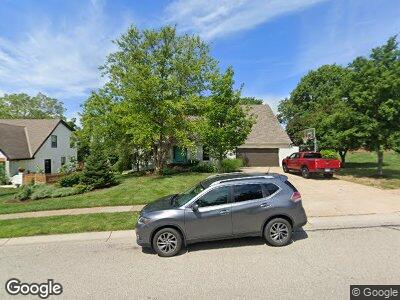
5710 Noland Rd Shawnee, KS 66216
Estimated Value: $424,396 - $457,000
4
Beds
4
Baths
2,399
Sq Ft
$183/Sq Ft
Est. Value
About This Home
This home is located at 5710 Noland Rd, Shawnee, KS 66216 and is currently estimated at $439,099, approximately $183 per square foot. 5710 Noland Rd is a home located in Johnson County with nearby schools including Ray Marsh Elementary School, Trailridge Middle School, and Shawnee Mission Northwest High School.
Ownership History
Date
Name
Owned For
Owner Type
Purchase Details
Closed on
May 30, 2002
Sold by
Dodge Larry A and Dodge Jean L
Bought by
Dean Darrell P and Dean Maria L
Current Estimated Value
Home Financials for this Owner
Home Financials are based on the most recent Mortgage that was taken out on this home.
Original Mortgage
$159,750
Interest Rate
6.92%
Purchase Details
Closed on
May 8, 2001
Sold by
Herndon David and Herndon Carol
Bought by
Dodge Larry A and Dodge Jean L
Home Financials for this Owner
Home Financials are based on the most recent Mortgage that was taken out on this home.
Original Mortgage
$175,750
Interest Rate
6.83%
Create a Home Valuation Report for This Property
The Home Valuation Report is an in-depth analysis detailing your home's value as well as a comparison with similar homes in the area
Home Values in the Area
Average Home Value in this Area
Purchase History
| Date | Buyer | Sale Price | Title Company |
|---|---|---|---|
| Dean Darrell P | -- | Old Republic Title Company | |
| Dodge Larry A | -- | Guarantee Title |
Source: Public Records
Mortgage History
| Date | Status | Borrower | Loan Amount |
|---|---|---|---|
| Open | Dean Darrell P | $120,000 | |
| Open | Dean Darrell P | $198,000 | |
| Closed | Dean Darrell P | $100,000 | |
| Closed | Dean Darrell P | $30,000 | |
| Closed | Dean Darrell P | $140,000 | |
| Closed | Dean Darrell P | $140,000 | |
| Closed | Dean Darrell P | $159,750 | |
| Previous Owner | Dodge Larry A | $175,750 |
Source: Public Records
Tax History Compared to Growth
Tax History
| Year | Tax Paid | Tax Assessment Tax Assessment Total Assessment is a certain percentage of the fair market value that is determined by local assessors to be the total taxable value of land and additions on the property. | Land | Improvement |
|---|---|---|---|---|
| 2024 | $4,566 | $43,079 | $7,823 | $35,256 |
| 2023 | $4,647 | $43,309 | $7,823 | $35,486 |
| 2022 | $4,368 | $40,572 | $7,823 | $32,749 |
| 2021 | $3,958 | $34,534 | $7,109 | $27,425 |
| 2020 | $3,911 | $33,683 | $6,464 | $27,219 |
| 2019 | $3,851 | $33,143 | $5,916 | $27,227 |
| 2018 | $3,626 | $31,085 | $5,916 | $25,169 |
| 2017 | $3,132 | $26,404 | $5,377 | $21,027 |
| 2016 | $3,151 | $26,231 | $5,377 | $20,854 |
| 2015 | $2,886 | $24,932 | $5,377 | $19,555 |
| 2013 | -- | $21,597 | $5,377 | $16,220 |
Source: Public Records
Map
Nearby Homes
- 5857 Park Cir
- 5850 Park Cir
- 5860 Park St Unit 4
- 5870 Park St Unit 2
- 4908 Noland Rd
- 13821 W 58th Terrace Unit 5
- 13605 W 54th St
- 6106 Park St
- 13896 W 57th St
- 6126 Park St
- 5329 Park St
- 6143 Park St
- 6145 Park St
- N/A Widmer Rd
- 6150 Park St
- 14003 W 58th Place
- 12029 W 58th Place
- 14315 W 58th Terrace
- 12610 W 52nd St
- 14316 W 56th Place