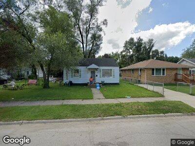
572 E May St Benton Harbor, MI 49022
District 3 NeighborhoodEstimated Value: $70,477 - $107,000
2
Beds
1
Bath
720
Sq Ft
$113/Sq Ft
Est. Value
About This Home
This home is located at 572 E May St, Benton Harbor, MI 49022 and is currently estimated at $81,119, approximately $112 per square foot. 572 E May St is a home located in Berrien County with nearby schools including Fair Plain Middle School, Benton Harbor High School, and St. Matthew S Lutheran School.
Ownership History
Date
Name
Owned For
Owner Type
Purchase Details
Closed on
Oct 12, 2007
Sold by
Rose Land & Finance Corp
Bought by
Wade Matthew Lewis
Current Estimated Value
Home Financials for this Owner
Home Financials are based on the most recent Mortgage that was taken out on this home.
Original Mortgage
$12,525
Interest Rate
6.33%
Mortgage Type
Purchase Money Mortgage
Purchase Details
Closed on
Oct 1, 2007
Sold by
First National Acceptance Co
Bought by
Rose Land & Finance Corp
Home Financials for this Owner
Home Financials are based on the most recent Mortgage that was taken out on this home.
Original Mortgage
$12,525
Interest Rate
6.33%
Mortgage Type
Purchase Money Mortgage
Purchase Details
Closed on
Oct 10, 2006
Sold by
Robinson Maxine
Bought by
First National Acceptance Co
Purchase Details
Closed on
Feb 13, 2001
Purchase Details
Closed on
Jun 29, 1995
Purchase Details
Closed on
Apr 1, 1975
Create a Home Valuation Report for This Property
The Home Valuation Report is an in-depth analysis detailing your home's value as well as a comparison with similar homes in the area
Home Values in the Area
Average Home Value in this Area
Purchase History
| Date | Buyer | Sale Price | Title Company |
|---|---|---|---|
| Wade Matthew Lewis | $12,000 | None Available | |
| Rose Land & Finance Corp | -- | None Available | |
| First National Acceptance Co | -- | None Available | |
| -- | $18,000 | -- | |
| -- | $18,000 | -- | |
| -- | $18,000 | -- |
Source: Public Records
Mortgage History
| Date | Status | Borrower | Loan Amount |
|---|---|---|---|
| Closed | Wade Matthew Lewis | $12,525 |
Source: Public Records
Tax History Compared to Growth
Tax History
| Year | Tax Paid | Tax Assessment Tax Assessment Total Assessment is a certain percentage of the fair market value that is determined by local assessors to be the total taxable value of land and additions on the property. | Land | Improvement |
|---|---|---|---|---|
| 2024 | $766 | $23,900 | $0 | $0 |
| 2023 | $613 | $16,600 | $0 | $0 |
| 2022 | $696 | $12,300 | $0 | $0 |
| 2021 | $1,495 | $12,000 | $700 | $11,300 |
| 2020 | $691 | $12,200 | $0 | $0 |
| 2019 | $681 | $10,800 | $0 | $0 |
| 2018 | $744 | $11,000 | $0 | $0 |
| 2017 | $776 | $11,700 | $0 | $0 |
| 2016 | $1,068 | $11,800 | $0 | $0 |
| 2015 | $867 | $11,400 | $0 | $0 |
| 2014 | $768 | $13,800 | $0 | $0 |
Source: Public Records
Map
Nearby Homes
- 1219 Ogden Ave
- 960 Union Ave
- 970 Monroe St
- 1142 Agard Ave
- 1014 Superior St
- 1127 Agard Ave
- 1275 Superior St
- 1318 Monroe St
- 635 E Empire Ave
- 1309 Union Ave
- 0 Ogden Ave
- 1336 Agard Ave
- 0 Milton St
- 1332 Columbus Ave
- 407 Clay St
- 1380 Milton St
- 749 Pipestone St
- 1472 Agard Ave
- 1003 Lavette Ave
- 979 Lavette Ave