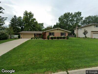
5855 Rocky Rill Rd Columbus, OH 43235
Indian Hills NeighborhoodEstimated Value: $489,000 - $573,745
3
Beds
3
Baths
2,272
Sq Ft
$237/Sq Ft
Est. Value
About This Home
This home is located at 5855 Rocky Rill Rd, Columbus, OH 43235 and is currently estimated at $538,686, approximately $237 per square foot. 5855 Rocky Rill Rd is a home located in Franklin County with nearby schools including Gables Elementary School, Ridgeview Middle School, and Centennial High School.
Ownership History
Date
Name
Owned For
Owner Type
Purchase Details
Closed on
Nov 29, 2022
Sold by
Mayo James D
Bought by
Krouse Deanne and Doty Cheryl
Current Estimated Value
Purchase Details
Closed on
Jul 19, 2021
Sold by
Cathy Mayo
Bought by
Ohio Department Of Medicaid
Purchase Details
Closed on
Jan 23, 2021
Sold by
Mayo Cathy B
Bought by
Mayo James D
Purchase Details
Closed on
Jun 1, 2009
Sold by
Downs Stephen M and Tidwell Lorah M
Bought by
Mayo James D and Mayo Cathy B
Home Financials for this Owner
Home Financials are based on the most recent Mortgage that was taken out on this home.
Original Mortgage
$75,000
Interest Rate
4.85%
Mortgage Type
Purchase Money Mortgage
Purchase Details
Closed on
May 1, 1980
Create a Home Valuation Report for This Property
The Home Valuation Report is an in-depth analysis detailing your home's value as well as a comparison with similar homes in the area
Home Values in the Area
Average Home Value in this Area
Purchase History
| Date | Buyer | Sale Price | Title Company |
|---|---|---|---|
| Krouse Deanne | $500,000 | Chicago Title | |
| Ohio Department Of Medicaid | -- | -- | |
| Mayo James D | -- | None Available | |
| Mayo James D | $190,000 | Attorney | |
| -- | $78,900 | -- |
Source: Public Records
Mortgage History
| Date | Status | Borrower | Loan Amount |
|---|---|---|---|
| Previous Owner | Mayo James D | $75,000 |
Source: Public Records
Tax History Compared to Growth
Tax History
| Year | Tax Paid | Tax Assessment Tax Assessment Total Assessment is a certain percentage of the fair market value that is determined by local assessors to be the total taxable value of land and additions on the property. | Land | Improvement |
|---|---|---|---|---|
| 2024 | $5,941 | $132,380 | $52,820 | $79,560 |
| 2023 | $5,865 | $132,370 | $52,815 | $79,555 |
| 2022 | $5,588 | $107,740 | $30,560 | $77,180 |
| 2021 | $5,598 | $107,740 | $30,560 | $77,180 |
| 2020 | $5,605 | $107,740 | $30,560 | $77,180 |
| 2019 | $5,204 | $85,790 | $24,430 | $61,360 |
| 2018 | $4,633 | $85,790 | $24,430 | $61,360 |
| 2017 | $5,201 | $85,790 | $24,430 | $61,360 |
| 2016 | $4,487 | $67,730 | $19,920 | $47,810 |
| 2015 | $4,073 | $67,730 | $19,920 | $47,810 |
| 2014 | $4,083 | $67,730 | $19,920 | $47,810 |
| 2013 | $1,918 | $64,505 | $18,970 | $45,535 |
Source: Public Records
Map
Nearby Homes
- 1040 Larkstone Dr
- 5580 Millington Rd
- 5341 Castle Pines
- 917 White Willow Ln Unit 917
- 1208 Cambria Ct
- 1157 Strathaven Ct W
- 5312 Courtney Place
- 511 W Kanawha Ave
- 6212 Hutchinson St
- 5227 Winsome Way Unit 5227
- 1310 Lakeside Place
- 6500 Plesenton Dr
- 410 Fenway Rd Unit B
- 1132 Langland Dr
- 274 Broad Meadows Blvd Unit 272
- 314 W Kanawha Ave
- 247 W Southington Ave
- 5653 Northbrook Dr W
- 6765 Lakeside Cir E
- 1314-1316 Cambrian Ct