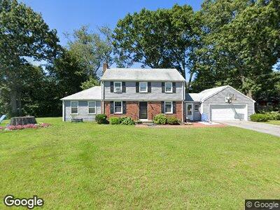
59 Marnoch Dr Seekonk, MA 02771
Monroes-South Seekonk NeighborhoodEstimated Value: $552,000 - $662,000
4
Beds
2
Baths
1,856
Sq Ft
$331/Sq Ft
Est. Value
About This Home
This home is located at 59 Marnoch Dr, Seekonk, MA 02771 and is currently estimated at $614,807, approximately $331 per square foot. 59 Marnoch Dr is a home located in Bristol County with nearby schools including Seekonk High School, St Mary Academy-Bay View, and Providence Country Day School.
Ownership History
Date
Name
Owned For
Owner Type
Purchase Details
Closed on
Jan 19, 2001
Sold by
Longworth John C and Longworth Patricia
Bought by
Lehourites Peter C and Lehourites Polly
Current Estimated Value
Home Financials for this Owner
Home Financials are based on the most recent Mortgage that was taken out on this home.
Original Mortgage
$167,900
Interest Rate
7.52%
Mortgage Type
Purchase Money Mortgage
Create a Home Valuation Report for This Property
The Home Valuation Report is an in-depth analysis detailing your home's value as well as a comparison with similar homes in the area
Home Values in the Area
Average Home Value in this Area
Purchase History
| Date | Buyer | Sale Price | Title Company |
|---|---|---|---|
| Lehourites Peter C | $209,900 | -- |
Source: Public Records
Mortgage History
| Date | Status | Borrower | Loan Amount |
|---|---|---|---|
| Open | Lehour1tes Polly | $130,000 | |
| Closed | Lehourites Peter C | $168,000 | |
| Closed | Lehourites Peter C | $195,000 | |
| Closed | Lehourites Peter C | $165,000 | |
| Closed | Lehourites Peter C | $167,900 |
Source: Public Records
Tax History Compared to Growth
Tax History
| Year | Tax Paid | Tax Assessment Tax Assessment Total Assessment is a certain percentage of the fair market value that is determined by local assessors to be the total taxable value of land and additions on the property. | Land | Improvement |
|---|---|---|---|---|
| 2025 | $5,859 | $474,400 | $179,700 | $294,700 |
| 2024 | $5,629 | $455,800 | $179,700 | $276,100 |
| 2023 | $5,425 | $413,800 | $161,400 | $252,400 |
| 2022 | $4,741 | $376,700 | $161,400 | $215,300 |
| 2021 | $4,741 | $349,400 | $138,300 | $211,100 |
| 2020 | $4,412 | $335,000 | $138,300 | $196,700 |
| 2019 | $4,284 | $328,000 | $138,300 | $189,700 |
| 2018 | $4,249 | $318,300 | $138,300 | $180,000 |
| 2017 | $4,193 | $311,500 | $139,900 | $171,600 |
| 2016 | $3,866 | $288,300 | $127,000 | $161,300 |
| 2015 | $3,786 | $286,200 | $127,000 | $159,200 |
Source: Public Records
Map
Nearby Homes
- 74 Warren Ave
- 21 Warren Ave Unit 5
- 1550 Fall River Ave
- 7 Jill Ct
- 38 Apple Orchard Ln
- 3 Aubin St
- 1705 Wampanoag Trail
- 12 Grassy Plain Rd
- 1737 Wampanoag Trail
- 4 Sherbrooke Rd
- 1 Tall Pines Dr
- 6 Christine Dr
- 25 Edgewood Dr
- 633 County Rd
- 47 Barneyville Rd
- 10 Holland Ave
- 5 Colfall St
- 670 Willett Ave
- 70 Somerset Ave
- 210 Olney St