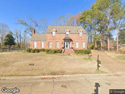
5909 Holbrook Dr Jackson, MS 39206
North Jackson NeighborhoodEstimated Value: $284,000 - $340,000
3
Beds
3
Baths
3,221
Sq Ft
$94/Sq Ft
Est. Value
About This Home
This home is located at 5909 Holbrook Dr, Jackson, MS 39206 and is currently estimated at $302,729, approximately $93 per square foot. 5909 Holbrook Dr is a home located in Hinds County with nearby schools including Green Elementary School, Powell Middle School, and Callaway High School.
Ownership History
Date
Name
Owned For
Owner Type
Purchase Details
Closed on
Sep 17, 2021
Sold by
Reddix Michael A
Bought by
Reddix Michael A and Reddix Laura Gans
Current Estimated Value
Home Financials for this Owner
Home Financials are based on the most recent Mortgage that was taken out on this home.
Original Mortgage
$110,000
Interest Rate
2.2%
Mortgage Type
Purchase Money Mortgage
Purchase Details
Closed on
May 4, 2016
Sold by
Reddix Carl M
Bought by
Reddix Michael A
Purchase Details
Closed on
Oct 29, 2014
Sold by
Anderson Gary L and Anderson Debra M
Bought by
Reddix Carl M
Create a Home Valuation Report for This Property
The Home Valuation Report is an in-depth analysis detailing your home's value as well as a comparison with similar homes in the area
Home Values in the Area
Average Home Value in this Area
Purchase History
| Date | Buyer | Sale Price | Title Company |
|---|---|---|---|
| Reddix Michael A | -- | None Available | |
| Reddix Michael A | -- | None Available | |
| Reddix Carl M | -- | None Available |
Source: Public Records
Mortgage History
| Date | Status | Borrower | Loan Amount |
|---|---|---|---|
| Previous Owner | Reddix Michael A | $110,000 |
Source: Public Records
Tax History Compared to Growth
Tax History
| Year | Tax Paid | Tax Assessment Tax Assessment Total Assessment is a certain percentage of the fair market value that is determined by local assessors to be the total taxable value of land and additions on the property. | Land | Improvement |
|---|---|---|---|---|
| 2024 | $4,343 | $24,018 | $4,000 | $20,018 |
| 2023 | $4,343 | $24,018 | $4,000 | $20,018 |
| 2022 | $6,933 | $36,027 | $6,000 | $30,027 |
| 2021 | $4,322 | $24,018 | $4,000 | $20,018 |
| 2020 | $1,080 | $23,699 | $4,000 | $19,699 |
| 2019 | $4,193 | $23,465 | $4,000 | $19,465 |
| 2018 | $4,143 | $23,465 | $4,000 | $19,465 |
| 2017 | $6,492 | $35,198 | $6,000 | $29,198 |
| 2016 | $6,492 | $35,198 | $6,000 | $29,198 |
| 2015 | $6,249 | $34,907 | $6,000 | $28,907 |
| 2014 | $3,861 | $23,271 | $4,000 | $19,271 |
Source: Public Records
Map
Nearby Homes
- 0 Hallmark Dr Unit 4106877
- 0 Hallmark Dr Unit 4106874
- 0 Hallmark Dr Unit 4099950
- 0 Hall Mark Dr
- 863 Rutherford Dr
- 811 Rutherford Dr
- 864 Woodlake Dr
- 135 Bedford Ln
- 221 Northgate Blvd
- 751 Windward Rd
- 338 Lake of Pines Dr
- 6037 Floral Dr
- 13 N Livingston Rd
- 742 Heather Ln
- 4888 Watkins Dr
- 612 Heather Ln
- 0 Forest Ave Unit 4109194
- 5604 Hearn St
- 4510 Kirkley Dr
- 000 Cole Rd