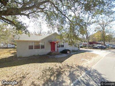
5922 Highway Ave Jacksonville, FL 32254
Marietta NeighborhoodEstimated Value: $103,027 - $274,000
4
Beds
3
Baths
2,200
Sq Ft
$80/Sq Ft
Est. Value
About This Home
This home is located at 5922 Highway Ave, Jacksonville, FL 32254 and is currently estimated at $175,757, approximately $79 per square foot. 5922 Highway Ave is a home located in Duval County with nearby schools including Ramona Boulevard Elementary School, Lake Shore Middle School, and Riverside High School.
Ownership History
Date
Name
Owned For
Owner Type
Purchase Details
Closed on
May 20, 2022
Sold by
Bureau Jack N & Kimberly H
Bought by
Shaws Land Properties Llc
Current Estimated Value
Home Financials for this Owner
Home Financials are based on the most recent Mortgage that was taken out on this home.
Original Mortgage
$80,000
Outstanding Balance
$52,402
Interest Rate
4.43%
Mortgage Type
Seller Take Back
Estimated Equity
$64,983
Purchase Details
Closed on
Jan 17, 2019
Sold by
Brannen John Keith and Brannen Kenneth Mark
Bought by
Bureau Jack N and Bureau Kimberly H
Purchase Details
Closed on
Jan 29, 2013
Sold by
Brannen Keith
Bought by
Brannen Kenneth A
Purchase Details
Closed on
Jan 20, 2010
Sold by
Brannen Kenneth A
Bought by
Brannen Keith
Create a Home Valuation Report for This Property
The Home Valuation Report is an in-depth analysis detailing your home's value as well as a comparison with similar homes in the area
Home Values in the Area
Average Home Value in this Area
Purchase History
| Date | Buyer | Sale Price | Title Company |
|---|---|---|---|
| Bureau Jack N | $30,000 | Attorney | |
| Brannen Kenneth A | -- | Attorney | |
| Brannen Keith | -- | Attorney |
Source: Public Records
Tax History Compared to Growth
Tax History
| Year | Tax Paid | Tax Assessment Tax Assessment Total Assessment is a certain percentage of the fair market value that is determined by local assessors to be the total taxable value of land and additions on the property. | Land | Improvement |
|---|---|---|---|---|
| 2024 | $1,935 | $85,794 | $21,852 | $63,942 |
| 2023 | $1,935 | $86,716 | $20,171 | $66,545 |
| 2022 | $831 | $26,575 | $20,171 | $6,404 |
| 2021 | $823 | $25,425 | $20,171 | $5,254 |
| 2020 | $826 | $25,201 | $20,171 | $5,030 |
| 2019 | $823 | $25,144 | $20,171 | $4,973 |
| 2018 | $1,932 | $83,719 | $20,171 | $63,548 |
| 2017 | $2,007 | $86,856 | $24,450 | $62,406 |
| 2016 | $1,508 | $86,051 | $0 | $0 |
| 2015 | $1,286 | $72,218 | $0 | $0 |
| 2014 | $1,240 | $69,306 | $0 | $0 |
Source: Public Records
Map
Nearby Homes
- 243 Lane Ave S
- 0 Arnold Ave
- 0 Monte St
- 775 Talking Tree Dr
- 771 Talking Tree Dr
- 5615 Atlee Ave
- 758 Ellis Rd S
- 753 Bent Baum Rd
- 631 Stevens St
- 6971 Wadsworth Ave
- 6742 Grace Ln
- 7025 Australian Ave
- 949 Granville Rd
- 5234 Bland Rd
- 6970 Deauville Rd
- 6922 Rollo Rd
- 7150 Natal Ave
- 6826 Arques Rd
- 6903 Arques Rd
- 7054 Deauville Rd