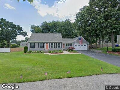
60 Narrows Rd Bristol, RI 02809
The Narrows NeighborhoodEstimated Value: $704,000 - $735,000
4
Beds
2
Baths
2,695
Sq Ft
$267/Sq Ft
Est. Value
About This Home
This home is located at 60 Narrows Rd, Bristol, RI 02809 and is currently estimated at $719,729, approximately $267 per square foot. 60 Narrows Rd is a home located in Bristol County with nearby schools including Mt. Hope High School, Highlander Charter Middle and High School, and Our Lady of Mt. Carmel School.
Ownership History
Date
Name
Owned For
Owner Type
Purchase Details
Closed on
Jul 1, 2024
Sold by
Gill Ft and Gill
Bought by
Whooley Kevin and Whooley Carol A
Current Estimated Value
Home Financials for this Owner
Home Financials are based on the most recent Mortgage that was taken out on this home.
Original Mortgage
$435,000
Outstanding Balance
$433,928
Interest Rate
7.02%
Mortgage Type
Purchase Money Mortgage
Estimated Equity
$270,568
Purchase Details
Closed on
Apr 18, 2011
Sold by
Gill Michael J and Gill Jane M
Bought by
Gill Ft
Purchase Details
Closed on
--
Sold by
Gill Michael J and Gill Jane M
Bought by
Gill Ft and Gill
Create a Home Valuation Report for This Property
The Home Valuation Report is an in-depth analysis detailing your home's value as well as a comparison with similar homes in the area
Home Values in the Area
Average Home Value in this Area
Purchase History
| Date | Buyer | Sale Price | Title Company |
|---|---|---|---|
| Whooley Kevin | $685,000 | None Available | |
| Whooley Kevin | $685,000 | None Available | |
| Gill Ft | -- | -- | |
| Gill Ft | -- | -- | |
| Gill Michael J | $133,000 | -- | |
| Sullivan John B | $142,000 | -- |
Source: Public Records
Mortgage History
| Date | Status | Borrower | Loan Amount |
|---|---|---|---|
| Open | Whooley Kevin | $435,000 | |
| Closed | Whooley Kevin | $435,000 | |
| Previous Owner | Gill Ft | $499,999 | |
| Previous Owner | Sullivan John B | $100,000 | |
| Previous Owner | Sullivan John B | $100,000 | |
| Previous Owner | Sullivan John B | $14,000 |
Source: Public Records
Tax History Compared to Growth
Tax History
| Year | Tax Paid | Tax Assessment Tax Assessment Total Assessment is a certain percentage of the fair market value that is determined by local assessors to be the total taxable value of land and additions on the property. | Land | Improvement |
|---|---|---|---|---|
| 2024 | $6,471 | $468,200 | $169,300 | $298,900 |
| 2023 | $6,255 | $468,200 | $169,300 | $298,900 |
| 2022 | $6,087 | $468,200 | $169,300 | $298,900 |
| 2021 | $5,499 | $382,400 | $155,900 | $226,500 |
| 2020 | $5,380 | $382,400 | $155,900 | $226,500 |
| 2019 | $5,247 | $382,400 | $155,900 | $226,500 |
| 2018 | $5,987 | $389,300 | $148,800 | $240,500 |
| 2017 | $4,707 | $315,500 | $128,900 | $186,600 |
| 2016 | $4,660 | $315,500 | $128,900 | $186,600 |
| 2015 | $4,426 | $315,500 | $128,900 | $186,600 |
| 2014 | $4,534 | $347,200 | $132,550 | $214,650 |
Source: Public Records
Map
Nearby Homes
- 36 Division St
- 50 Belvedere Dr
- 111 King Philip Ave
- 11 Basswood Dr
- 0 Wilcox St Unit 1353240
- 18 Harrison St
- 44 Harrison St
- 25 Sandy Ln
- 99 Smith St
- 669 Metacom Ave Unit 26
- 671 Metacom Ave Unit 38
- 671 Metacom Ave Unit 34
- 9 Mount Ave
- 56 Sherman Ave
- 426 Metacom Ave
- 18 Sherman Ave
- 3 Knowlton Ct
- 423 Metacom Ave
- 82 Sherry Ave
- 36 Brooks Farm Dr