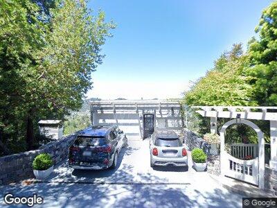
60 Upper Toyon Dr Kentfield, CA 94904
Gerstle Park NeighborhoodEstimated Value: $3,193,000 - $4,580,985
3
Beds
4
Baths
4,000
Sq Ft
$972/Sq Ft
Est. Value
About This Home
This home is located at 60 Upper Toyon Dr, Kentfield, CA 94904 and is currently estimated at $3,887,996, approximately $971 per square foot. 60 Upper Toyon Dr is a home located in Marin County with nearby schools including Ross Elementary School, Redwood High School, and Lindamood-Bell Learning Processes San Rafael.
Ownership History
Date
Name
Owned For
Owner Type
Purchase Details
Closed on
Nov 1, 2024
Sold by
Strang Dale Wesley and Strang Sandra L
Bought by
Strang Family Trust and Strang
Current Estimated Value
Purchase Details
Closed on
Jun 11, 1999
Sold by
Mallery Thomas M and Mallery Christine M
Bought by
Strang Dale W and Strang Sandra L
Home Financials for this Owner
Home Financials are based on the most recent Mortgage that was taken out on this home.
Original Mortgage
$875,000
Interest Rate
7.25%
Purchase Details
Closed on
May 29, 1998
Sold by
Kerzner Jay J
Bought by
Cheney Norman R and Cheney Brenda J
Home Financials for this Owner
Home Financials are based on the most recent Mortgage that was taken out on this home.
Original Mortgage
$865,000
Interest Rate
6.87%
Purchase Details
Closed on
May 26, 1998
Sold by
Kerzner Jay J
Bought by
Mallery Thomas M and Mallery Christine M
Home Financials for this Owner
Home Financials are based on the most recent Mortgage that was taken out on this home.
Original Mortgage
$865,000
Interest Rate
6.87%
Purchase Details
Closed on
Feb 17, 1995
Sold by
Kerzner Jay J and Hindman David Scott
Bought by
Kerzner Jay J
Purchase Details
Closed on
Jul 15, 1994
Sold by
Kerzner Jay J and Hindman David Scott
Bought by
Kerzner Jay J and Hindman David Scott
Home Financials for this Owner
Home Financials are based on the most recent Mortgage that was taken out on this home.
Original Mortgage
$734,000
Interest Rate
8.57%
Create a Home Valuation Report for This Property
The Home Valuation Report is an in-depth analysis detailing your home's value as well as a comparison with similar homes in the area
Home Values in the Area
Average Home Value in this Area
Purchase History
| Date | Buyer | Sale Price | Title Company |
|---|---|---|---|
| Strang Family Trust | -- | None Listed On Document | |
| Strang Dale W | $1,250,000 | Old Republic Title Company | |
| Cheney Norman R | $17,000 | California Land Title Co | |
| Mallery Thomas M | $1,190,000 | California Land Title Co | |
| Kerzner Jay J | $115,909 | -- | |
| Kerzner Jay J | -- | California Land Title Co |
Source: Public Records
Mortgage History
| Date | Status | Borrower | Loan Amount |
|---|---|---|---|
| Previous Owner | Strang Dale W | $100,000 | |
| Previous Owner | Strang Dale W | $1,810,000 | |
| Previous Owner | Strang Dale W | $1,780,000 | |
| Previous Owner | Strang Dale W | $400,000 | |
| Previous Owner | Strang Dale W | $1,245,000 | |
| Previous Owner | Strang Dale W | $1,245,000 | |
| Previous Owner | Strang Dale W | $150,000 | |
| Previous Owner | Strang Dale W | $1,235,000 | |
| Previous Owner | Strang Dale W | $200,000 | |
| Previous Owner | Strang Dale W | $1,131,000 | |
| Previous Owner | Strang Dale W | $150,000 | |
| Previous Owner | Strang Dale W | $80,000 | |
| Previous Owner | Strang Dale W | $1,000,000 | |
| Previous Owner | Strang Dale W | $875,000 | |
| Previous Owner | Mallery Thomas M | $865,000 | |
| Previous Owner | Kerzner Jay J | $734,000 |
Source: Public Records
Tax History Compared to Growth
Tax History
| Year | Tax Paid | Tax Assessment Tax Assessment Total Assessment is a certain percentage of the fair market value that is determined by local assessors to be the total taxable value of land and additions on the property. | Land | Improvement |
|---|---|---|---|---|
| 2024 | $25,062 | $1,883,436 | $1,009,520 | $873,916 |
| 2023 | $24,661 | $1,846,512 | $989,729 | $856,783 |
| 2022 | $23,828 | $1,810,312 | $970,326 | $839,986 |
| 2021 | $23,416 | $1,774,824 | $951,304 | $823,520 |
| 2020 | $23,127 | $1,756,637 | $941,556 | $815,081 |
| 2019 | $22,289 | $1,722,199 | $923,097 | $799,102 |
| 2018 | $21,820 | $1,688,437 | $905,001 | $783,436 |
| 2017 | $21,383 | $1,655,336 | $887,259 | $768,077 |
| 2016 | $20,402 | $1,622,887 | $869,866 | $753,021 |
| 2015 | $20,363 | $1,598,512 | $856,801 | $741,711 |
| 2014 | $19,434 | $1,567,199 | $840,017 | $727,182 |
Source: Public Records
Map
Nearby Homes
- 162 Wolfe Grade
- 32 Wolfe Canyon Rd
- 10 Arroyo Dr
- 236 C St
- 14 Alvina Ave
- 31 Martens Blvd
- 407 Woodland Ave
- 33 Wolfe Grade
- 14 Kentdale Ln
- 51 Laurel Grove Ave
- 513 C St
- 20 Knoll Rd
- 205 Vista Grande
- 59 Knoll Rd
- 544 Bret Harte Rd
- 0 Clayton St
- 5 Makin Grade
- 821 Sir Francis Drake Blvd
- 838 Sir Francis Drake Blvd Unit 2
- 331 Irwin St