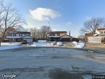
600 N Point Dr Schaumburg, IL 60193
South Schaumburg NeighborhoodEstimated Value: $556,000 - $649,000
3
Beds
3
Baths
2,268
Sq Ft
$264/Sq Ft
Est. Value
About This Home
This home is located at 600 N Point Dr, Schaumburg, IL 60193 and is currently estimated at $599,878, approximately $264 per square foot. 600 N Point Dr is a home located in Cook County with nearby schools including Michael Collins Elementary School, Robert Frost Junior High School, and J B Conant High School.
Ownership History
Date
Name
Owned For
Owner Type
Purchase Details
Closed on
Oct 18, 1995
Sold by
Stras Gerard E and Stras Donna M
Bought by
Stras Donna M and Donna M Stras Revocable Trust
Current Estimated Value
Create a Home Valuation Report for This Property
The Home Valuation Report is an in-depth analysis detailing your home's value as well as a comparison with similar homes in the area
Home Values in the Area
Average Home Value in this Area
Purchase History
| Date | Buyer | Sale Price | Title Company |
|---|---|---|---|
| Stras Donna M | -- | -- |
Source: Public Records
Mortgage History
| Date | Status | Borrower | Loan Amount |
|---|---|---|---|
| Closed | Stras Gerard E | $100,000 | |
| Closed | Stras Donna M | $99,250 |
Source: Public Records
Tax History Compared to Growth
Tax History
| Year | Tax Paid | Tax Assessment Tax Assessment Total Assessment is a certain percentage of the fair market value that is determined by local assessors to be the total taxable value of land and additions on the property. | Land | Improvement |
|---|---|---|---|---|
| 2024 | $9,329 | $40,501 | $12,014 | $28,487 |
| 2023 | $9,329 | $40,501 | $12,014 | $28,487 |
| 2022 | $9,329 | $40,501 | $12,014 | $28,487 |
| 2021 | $8,601 | $34,371 | $6,553 | $27,818 |
| 2020 | $8,575 | $34,371 | $6,553 | $27,818 |
| 2019 | $8,582 | $38,191 | $6,553 | $31,638 |
| 2018 | $8,469 | $34,402 | $5,734 | $28,668 |
| 2017 | $8,367 | $34,402 | $5,734 | $28,668 |
| 2016 | $9,356 | $38,152 | $5,734 | $32,418 |
| 2015 | $8,172 | $31,812 | $4,914 | $26,898 |
| 2014 | $8,110 | $31,812 | $4,914 | $26,898 |
| 2013 | $7,872 | $31,812 | $4,914 | $26,898 |
Source: Public Records
Map
Nearby Homes
- 625 Scholten Dr
- 704 Thames Dr
- 1049 Hampton Harbor Unit 9201
- 611 Merlin Dr
- 402 Drake Cir Unit 332A
- 1053 Newport Harbor Unit 1053
- 1072 Hampton Harbor Unit 1072
- 865 Eaton Ct
- 947 Glouchester Cir Unit 201B
- 1021 Brunswick Harbor Unit 1021
- 830 Knottingham Dr Unit 2B
- 920 Surrey Dr Unit 1A
- 605 S Point Dr
- 1117 Howard Dr
- 640 Cutter Ln
- 261 University Ln
- 297 University Ln Unit 196
- 784 Bluejay Cir
- 114 Wiltshire Ct
- 36 Shore Dr
