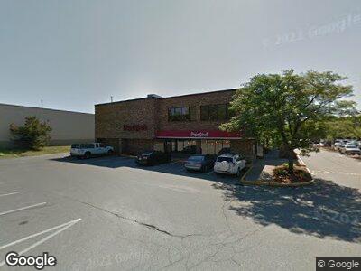
600 Providence Hwy Dedham, MA 02026
Dedham Village Neighborhood
--
Bed
9
Baths
49,480
Sq Ft
6
Acres
About This Home
This home is located at 600 Providence Hwy, Dedham, MA 02026. 600 Providence Hwy is a home located in Norfolk County with nearby schools including Oakdale Elementary School, Dedham Middle School, and Dedham High School.
Ownership History
Date
Name
Owned For
Owner Type
Purchase Details
Closed on
Jun 26, 2019
Sold by
Dedham Marketplace Llc
Bought by
Dedham Tic Partners Llc
Home Financials for this Owner
Home Financials are based on the most recent Mortgage that was taken out on this home.
Original Mortgage
$10,500,000
Outstanding Balance
$9,296,810
Interest Rate
3.82%
Mortgage Type
Credit Line Revolving
Purchase Details
Closed on
May 29, 2013
Sold by
71 Summer Street Rt and Valerio Michael A
Bought by
Dedham Marketplace Llc
Home Financials for this Owner
Home Financials are based on the most recent Mortgage that was taken out on this home.
Original Mortgage
$2,500,000
Interest Rate
3.45%
Mortgage Type
Commercial
Purchase Details
Closed on
Feb 11, 1982
Bought by
Dedham Marketplace Llc
Create a Home Valuation Report for This Property
The Home Valuation Report is an in-depth analysis detailing your home's value as well as a comparison with similar homes in the area
Home Values in the Area
Average Home Value in this Area
Purchase History
| Date | Buyer | Sale Price | Title Company |
|---|---|---|---|
| Dedham Tic Partners Llc | $10,600,000 | -- | |
| Dedham Marketplace Llc | -- | -- | |
| Dedham Marketplace Llc | -- | -- |
Source: Public Records
Mortgage History
| Date | Status | Borrower | Loan Amount |
|---|---|---|---|
| Open | Dedham Tic Partners Llc | $10,500,000 | |
| Previous Owner | Dedham Marketplace Llc | $2,500,000 | |
| Previous Owner | Dedham Marketplace Llc | $1,400,000 | |
| Previous Owner | Dedham Marketplace Llc | $500,000 | |
| Previous Owner | Dedham Marketplace Llc | $500,000 |
Source: Public Records
Tax History Compared to Growth
Tax History
| Year | Tax Paid | Tax Assessment Tax Assessment Total Assessment is a certain percentage of the fair market value that is determined by local assessors to be the total taxable value of land and additions on the property. | Land | Improvement |
|---|---|---|---|---|
| 2025 | $0 | $12,916,900 | $7,331,300 | $5,585,600 |
| 2024 | $0 | $12,296,000 | $6,996,000 | $5,300,000 |
| 2023 | $0 | $11,044,100 | $6,365,300 | $4,678,800 |
| 2022 | $0 | $10,504,200 | $5,946,100 | $4,558,100 |
| 2021 | $153,443 | $5,316,800 | $3,290,200 | $2,026,600 |
| 2020 | $150,635 | $5,248,600 | $3,046,200 | $2,202,400 |
| 2019 | $163,845 | $5,500,000 | $2,782,200 | $2,717,800 |
| 2018 | $191,238 | $6,233,300 | $2,607,100 | $3,626,200 |
| 2017 | $188,508 | $6,011,100 | $2,384,900 | $3,626,200 |
| 2016 | $191,542 | $5,800,800 | $2,175,800 | $3,625,000 |
| 2015 | $194,011 | $5,714,600 | $2,304,600 | $3,410,000 |
| 2014 | $194,783 | $5,610,100 | $2,200,100 | $3,410,000 |
Source: Public Records
Map
Nearby Homes
- 12 School St
- 46 Church St
- 62 Abbott Rd
- 39 Court St
- 362 East St
- 19 Court St Unit 202
- 325 East St
- 95 Gibson Ave
- 62 Old River Place
- 42 Churchill Place
- 56 Mount Vernon St
- 299 Central Ave
- 178 Mount Vernon St
- 14 Thompson St
- 188 Walnut St
- 31 Edison Ave
- 28 Boathouse Ln
- 203 Madison St
- 122 Horrigan Dr Unit 18
- 122 Horrigan Dr Unit 18