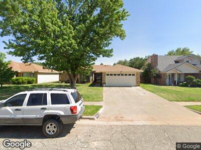
6013 72nd St Lubbock, TX 79424
Estimated Value: $187,000 - $216,000
3
Beds
2
Baths
1,532
Sq Ft
$134/Sq Ft
Est. Value
About This Home
This home is located at 6013 72nd St, Lubbock, TX 79424 and is currently estimated at $205,620, approximately $134 per square foot. 6013 72nd St is a home located in Lubbock County with nearby schools including Crestview Elementary School, Heritage Middle School, and Frenship High School.
Ownership History
Date
Name
Owned For
Owner Type
Purchase Details
Closed on
Mar 13, 2014
Sold by
Mandry Thomas W and Mandry Barbara R
Bought by
Mandry Properties Llc
Current Estimated Value
Purchase Details
Closed on
Apr 27, 2009
Sold by
Clough Myrl Charles
Bought by
Mandry Tom and Mandry Barbara
Purchase Details
Closed on
May 30, 2006
Sold by
Ellington Karen J and Mitchell Karen J
Bought by
Clough Mryl Charles
Create a Home Valuation Report for This Property
The Home Valuation Report is an in-depth analysis detailing your home's value as well as a comparison with similar homes in the area
Home Values in the Area
Average Home Value in this Area
Purchase History
| Date | Buyer | Sale Price | Title Company |
|---|---|---|---|
| Mandry Properties Llc | -- | None Available | |
| Mandry Tom | -- | Lubbock Abstract & Title Co | |
| Clough Mryl Charles | -- | None Available |
Source: Public Records
Tax History Compared to Growth
Tax History
| Year | Tax Paid | Tax Assessment Tax Assessment Total Assessment is a certain percentage of the fair market value that is determined by local assessors to be the total taxable value of land and additions on the property. | Land | Improvement |
|---|---|---|---|---|
| 2024 | $4,349 | $210,681 | $15,860 | $194,821 |
| 2023 | $4,265 | $203,677 | $15,860 | $187,817 |
| 2022 | $3,978 | $174,714 | $15,860 | $158,854 |
| 2021 | $3,808 | $157,462 | $15,860 | $141,602 |
| 2020 | $3,530 | $145,295 | $15,860 | $129,435 |
| 2019 | $3,372 | $134,877 | $15,860 | $119,017 |
| 2018 | $3,445 | $137,652 | $15,860 | $121,792 |
| 2017 | $3,313 | $132,199 | $15,860 | $116,339 |
| 2016 | $3,120 | $124,500 | $15,860 | $108,640 |
| 2015 | $2,930 | $120,461 | $12,200 | $108,261 |
| 2014 | $2,930 | $116,778 | $12,200 | $104,578 |
Source: Public Records
Map
Nearby Homes
- 6012 72nd St
- 6034 71st St
- 5909 72nd St
- 6907 Hope Ave
- 6010 76th St
- 6102 75th St
- 0 Homestead Ave
- 0 Homestead Ave Unit 202410272
- 0 Homestead Ave Unit 202410273
- 0 Homestead Ave Unit 202410271
- 0 Homestead Ave Unit 202410270
- 6017 76th St
- 6901 Grover Ave
- 6916 Fulton Ave
- 6009 77th St
- 5804 72nd St
- 6015 77th St
- 10701 Juneau Ave
- 6004 68th St
- 6910 Freeport Ave