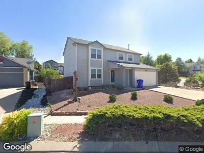
6024 Whetstone Dr Colorado Springs, CO 80923
Sundown NeighborhoodEstimated Value: $469,725 - $560,000
4
Beds
3
Baths
1,935
Sq Ft
$268/Sq Ft
Est. Value
About This Home
This home is located at 6024 Whetstone Dr, Colorado Springs, CO 80923 and is currently estimated at $517,931, approximately $267 per square foot. 6024 Whetstone Dr is a home located in El Paso County with nearby schools including Scott Elementary School, Jenkins Middle School, and Doherty High School.
Ownership History
Date
Name
Owned For
Owner Type
Purchase Details
Closed on
Apr 24, 2015
Sold by
Lewis Ronald Edgar
Bought by
Lewis Charlotte A
Current Estimated Value
Purchase Details
Closed on
Jan 28, 1998
Sold by
Legendary Homes Of Colorado Springs Inc
Bought by
Lewis Ronald Edgar and Lewis Charlotte A
Home Financials for this Owner
Home Financials are based on the most recent Mortgage that was taken out on this home.
Original Mortgage
$151,113
Interest Rate
7.07%
Mortgage Type
VA
Create a Home Valuation Report for This Property
The Home Valuation Report is an in-depth analysis detailing your home's value as well as a comparison with similar homes in the area
Home Values in the Area
Average Home Value in this Area
Purchase History
| Date | Buyer | Sale Price | Title Company |
|---|---|---|---|
| Lewis Charlotte A | -- | None Available | |
| Lewis Ronald Edgar | $148,200 | Unified Title Co Inc |
Source: Public Records
Mortgage History
| Date | Status | Borrower | Loan Amount |
|---|---|---|---|
| Open | Lewis Ronald Edgar | $144,550 | |
| Closed | Lewis Ronald Edgar | $151,113 | |
| Previous Owner | Legendary Homes Of Colorado Springs Inc | $111,000 |
Source: Public Records
Tax History Compared to Growth
Tax History
| Year | Tax Paid | Tax Assessment Tax Assessment Total Assessment is a certain percentage of the fair market value that is determined by local assessors to be the total taxable value of land and additions on the property. | Land | Improvement |
|---|---|---|---|---|
| 2024 | $1,176 | $32,690 | $5,310 | $27,380 |
| 2023 | $1,176 | $32,690 | $5,310 | $27,380 |
| 2022 | $879 | $21,620 | $4,400 | $17,220 |
| 2021 | $950 | $22,240 | $4,530 | $17,710 |
| 2020 | $672 | $16,510 | $3,930 | $12,580 |
| 2019 | $669 | $16,510 | $3,930 | $12,580 |
| 2018 | $560 | $14,440 | $3,170 | $11,270 |
| 2017 | $532 | $14,440 | $3,170 | $11,270 |
| 2016 | $453 | $14,630 | $3,330 | $11,300 |
| 2015 | $452 | $14,630 | $3,330 | $11,300 |
| 2014 | $869 | $13,550 | $3,330 | $10,220 |
Source: Public Records
Map
Nearby Homes
- 6065 Wheatgrass Dr
- 6060 Whetstone Dr
- 6460 Whirlwind Dr
- 5795 Corinth Dr
- 6315 Andersen Mill Heights Unit 204
- 6315 Andersen Mill Heights Unit 206
- 5755 Pamlico Dr
- 4709 Rowland Heights
- 6035 Grapevine Dr
- Lot 130 Santana Dr Unit 13
- 5560 Saddle Rock Rd
- 5140 Walking Horse Point
- 4753 Stormy Peaks Ct
- 4748 Templeton Gap Rd
- 4745 Paramount Place
- 6627 Wagon Ridge Dr
- 6655 Wagon Ridge Dr
- 4685 Paramount Place
- 5955 Maroon Mesa Dr
- 4435 Sable Ridge Ct