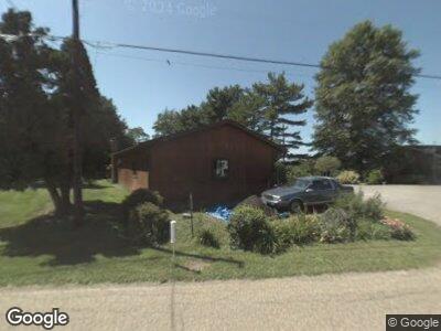
60962 Sandy Ridge Rd Barnesville, OH 43713
Estimated Value: $350,000
--
Bed
--
Bath
--
Sq Ft
1,307
Sq Ft Lot
About This Home
This home is located at 60962 Sandy Ridge Rd, Barnesville, OH 43713 and is currently estimated at $350,000. 60962 Sandy Ridge Rd is a home located in Belmont County with nearby schools including Barnesville Elementary School, Barnesville Middle School, and Barnesville High School.
Ownership History
Date
Name
Owned For
Owner Type
Purchase Details
Closed on
May 26, 2009
Sold by
Plumly Betty C
Bought by
Conway Larry A and Conway Peggy S
Current Estimated Value
Home Financials for this Owner
Home Financials are based on the most recent Mortgage that was taken out on this home.
Original Mortgage
$98,000
Interest Rate
4.85%
Mortgage Type
Purchase Money Mortgage
Purchase Details
Closed on
Jul 22, 1996
Sold by
Conway Larry A and Conway Peggy S
Bought by
Conway Larry A and Conway Peggy S
Purchase Details
Closed on
Jan 1, 1986
Sold by
Plumly Betty C
Bought by
Plumly Betty C
Create a Home Valuation Report for This Property
The Home Valuation Report is an in-depth analysis detailing your home's value as well as a comparison with similar homes in the area
Home Values in the Area
Average Home Value in this Area
Purchase History
| Date | Buyer | Sale Price | Title Company |
|---|---|---|---|
| Conway Larry A | -- | Attorney | |
| Conway Larry A | -- | -- | |
| Plumly Betty C | -- | -- |
Source: Public Records
Mortgage History
| Date | Status | Borrower | Loan Amount |
|---|---|---|---|
| Open | Mcfarland She4ila A | $100,000 | |
| Closed | Conway Larry A | $127,000 | |
| Closed | Conway Larry A | $98,000 | |
| Closed | Conway Larry A | $25,000 |
Source: Public Records
Tax History Compared to Growth
Tax History
| Year | Tax Paid | Tax Assessment Tax Assessment Total Assessment is a certain percentage of the fair market value that is determined by local assessors to be the total taxable value of land and additions on the property. | Land | Improvement |
|---|---|---|---|---|
| 2024 | $11 | $270 | $270 | -- |
| 2023 | $229 | $6,650 | $210 | $6,440 |
| 2022 | $229 | $6,642 | $206 | $6,436 |
| 2021 | $230 | $6,646 | $206 | $6,440 |
| 2020 | $209 | $5,780 | $180 | $5,600 |
| 2019 | $212 | $5,780 | $180 | $5,600 |
| 2018 | $211 | $5,780 | $180 | $5,600 |
| 2017 | $134 | $3,530 | $110 | $3,420 |
| 2016 | $131 | $3,530 | $110 | $3,420 |
| 2015 | $130 | $3,530 | $110 | $3,420 |
| 2014 | $152 | $4,020 | $90 | $3,930 |
| 2013 | $142 | $4,020 | $90 | $3,930 |
Source: Public Records
Map
Nearby Homes
- 60283 Pigeon Point Rd
- 0 Morgantown Ave
- 62265 Homestead Dr
- 105 Bethesda St
- 35355 County Road 122
- 410 Mulberry St
- 302 High St
- 136 E Walnut St
- 131 Cherry St
- 915 Bond Ave
- 410 N Chestnut St
- 315 Harrison St
- 336 W Church St
- 331 W Pike St
- 0 Ohio 800
- 63626 Brads Way
- 519 W Main St
- 126 Westview Dr
- 541 W Main St
- 37250 Harry's Ridge Rd