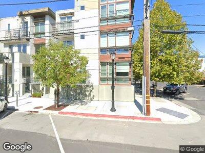
610 Warren St Redwood City, CA 94063
Downtown Redwood City NeighborhoodEstimated Value: $1,391,000 - $1,789,000
3
Beds
4
Baths
1,900
Sq Ft
$861/Sq Ft
Est. Value
About This Home
This home is located at 610 Warren St, Redwood City, CA 94063 and is currently estimated at $1,634,982, approximately $860 per square foot. 610 Warren St is a home located in San Mateo County with nearby schools including Clifford School, John F. Kennedy Middle School, and Sequoia High School.
Ownership History
Date
Name
Owned For
Owner Type
Purchase Details
Closed on
Aug 23, 2023
Sold by
Marques Taylor Ann
Bought by
Taylor Ann Marques Revocable Living Trust and Marques
Current Estimated Value
Purchase Details
Closed on
Mar 12, 2021
Sold by
Marques Michael A and Marques Taylor Ann
Bought by
Marques Taylor Ann
Purchase Details
Closed on
Aug 3, 2016
Sold by
Classics Rwc 1856 Lp
Bought by
Marques Michael A and Marques Taylor Ann
Home Financials for this Owner
Home Financials are based on the most recent Mortgage that was taken out on this home.
Original Mortgage
$1,470,610
Interest Rate
3.45%
Mortgage Type
New Conventional
Create a Home Valuation Report for This Property
The Home Valuation Report is an in-depth analysis detailing your home's value as well as a comparison with similar homes in the area
Home Values in the Area
Average Home Value in this Area
Purchase History
| Date | Buyer | Sale Price | Title Company |
|---|---|---|---|
| Taylor Ann Marques Revocable Living Trust | -- | None Listed On Document | |
| Marques Michael A | $1,771,000 | First American Title Company |
Source: Public Records
Mortgage History
| Date | Status | Borrower | Loan Amount |
|---|---|---|---|
| Previous Owner | Marques Michael A | $1,395,500 | |
| Previous Owner | Marques Michael A | $1,470,610 |
Source: Public Records
Tax History Compared to Growth
Tax History
| Year | Tax Paid | Tax Assessment Tax Assessment Total Assessment is a certain percentage of the fair market value that is determined by local assessors to be the total taxable value of land and additions on the property. | Land | Improvement |
|---|---|---|---|---|
| 2023 | $22,683 | $1,975,365 | $592,608 | $1,382,757 |
| 2022 | $21,308 | $1,936,634 | $580,989 | $1,355,645 |
| 2021 | $21,104 | $1,898,662 | $569,598 | $1,329,064 |
| 2020 | $20,824 | $1,879,195 | $563,758 | $1,315,437 |
| 2019 | $20,748 | $1,842,349 | $552,704 | $1,289,645 |
| 2018 | $20,213 | $1,806,225 | $541,867 | $1,264,358 |
| 2017 | $19,997 | $1,770,810 | $531,243 | $1,239,567 |
Source: Public Records
Map
Nearby Homes
- 1418 Lenolt St
- 308 B St
- 1140 Whipple Ave Unit 22
- 30 Clinton St
- 1518 Stafford St
- 1090 Main St Unit 401
- 720 Elm St
- 449 Grand St
- 736 Cedar St
- 622 Hilton St Unit 3
- 827 Chestnut St
- 315 King St
- 938 Fulton St
- 818 Vera Ave
- 1115 Davis St
- 1172 Clinton St
- 1120 Davis St
- 711 Roosevelt Ave
- 715 Roosevelt Ave
- 253 Oak Ave Unit 202
