6130 Wayne Rd Romulus, MI 48174
Estimated payment $1,283/month
About This Lot
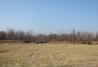
This 11.7 acre parcel is zoned C2. In addition, it is Master planned Multi-family residential, giving the buyer the potential to develop the property for uses allowed within the C2 zoning district or to develop the property for multi-family residential use (e.g. apartments or condos) or to split the parcel for mixed use.
The parcel was appraised by a Commercial Real Estate Appraiser (not a broker) for $195,000. The asking price is the price this land was appraised for. This parcel is the lowest for property zone C2 in the surrounding 342 square miles.
The parcel is traversed by a county drain. No vertical development (e.g. a building) is allowed over the drain area, but horizontal development ( e.g. a road) is allowed.
This site is in close proximity to the 84 acre Amazon Distribution Center in Romulus that is expected to bring in excess of 1,600 new jobs to the city and an economic impact of over 10.2 billion dollars to the city.
This location has a traffic count of nearly 16,000 cars per day, Median Household Income of $44,000 and proximity to I-94 of 2.25 miles.
Property Details
Property Type
- Land
Lot Details
- 11.7 Acre Lot
- Property is zoned Commercial, Multi-Family
Utilities
- Sewer in Street
Listing and Financial Details
- Assessor Parcel Number 80017990003000
Map
Home Values in the Area
Average Home Value in this Area
Tax History
| Year | Tax Paid | Tax Assessment Tax Assessment Total Assessment is a certain percentage of the fair market value that is determined by local assessors to be the total taxable value of land and additions on the property. | Land | Improvement |
|---|---|---|---|---|
| 2024 | $6,163 | $96,600 | $0 | $0 |
| 2023 | $6,212 | $96,600 | $0 | $0 |
| 2022 | $7,881 | $96,600 | $0 | $0 |
| 2021 | $7,579 | $96,600 | $0 | $0 |
| 2020 | $8,458 | $284,000 | $0 | $0 |
| 2019 | $11,904 | $173,000 | $0 | $0 |
| 2018 | $9,207 | $345,900 | $0 | $0 |
| 2017 | $9,471 | $345,900 | $0 | $0 |
| 2016 | $5,692 | $329,400 | $0 | $0 |
| 2015 | $6,644 | $329,400 | $0 | $0 |
| 2013 | $6,437 | $318,100 | $0 | $0 |
| 2012 | $2,540 | $369,200 | $369,200 | $0 |
Property History
| Date | Event | Price | Change | Sq Ft Price |
|---|---|---|---|---|
| 01/28/2025 01/28/25 | Price Changed | $195,000 | +34.5% | -- |
| 05/27/2024 05/27/24 | Price Changed | $145,000 | -25.6% | -- |
| 05/25/2020 05/25/20 | Price Changed | $195,000 | -17.0% | -- |
| 12/28/2019 12/28/19 | Price Changed | $235,000 | -31.3% | -- |
| 01/04/2019 01/04/19 | For Sale | $342,000 | -- | -- |
Deed History
| Date | Type | Sale Price | Title Company |
|---|---|---|---|
| Quit Claim Deed | $53,000 | None Available |
Source: Realcomp
MLS Number: 219001314
APN: 80-017-99-0003-000
Disclaimer: Certain information contained herein is derived from information provided by parties other than Homes.com. All information provided is deemed reliable, but is not guaranteed to be accurate and should be independently verified.
![]() IDX provided courtesy of Realcomp II Ltd. via Ten-X and MLS
IDX provided courtesy of Realcomp II Ltd. via Ten-X and MLS
Copyright 2025 Realcomp II Ltd. Shareholders
IDX information is provided exclusively for consumers' personal, noncommercial use and may not be used for any purpose other than to identify prospective properties consumers may be interested in purchasing. The accuracy of all information, regardless of source, is not guaranteed or warranted. All information should be independently verified.
Listing Information presented by local MLS brokerage: Ten-X, local REALTOR®- Arlene Richardson - (888)-952-6393
- 35930 Beverly Rd
- 35841 Vinewood St
- 35454 Glover St
- VAC Border St
- 000 Waynecorse
- 6505 Dexter St
- 35333 Stellwagen St
- 34800 van Born Rd
- 0 Arlene Ct
- 35344 Ecorse Rd
- 35300 Ecorse Rd
- 6291 Edmund St
- 6029 Edmund St
- 35047 Harroun St
- 5750 Southridge Dr
- 4519 Washington St
- 34030 Glover St
- 34560 Winslow St
- 4404 2nd St
- 34061 Richard St
