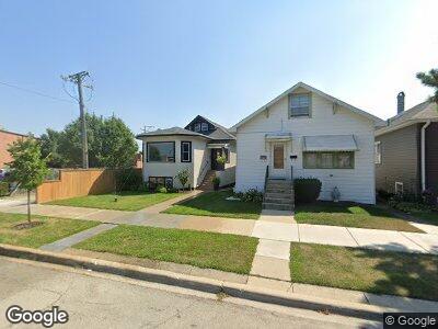
6137 W Peterson Ave Chicago, IL 60646
Norwood Park NeighborhoodEstimated Value: $520,000 - $588,000
4
Beds
3
Baths
3,200
Sq Ft
$175/Sq Ft
Est. Value
About This Home
This home is located at 6137 W Peterson Ave, Chicago, IL 60646 and is currently estimated at $560,430, approximately $175 per square foot. 6137 W Peterson Ave is a home located in Cook County with nearby schools including Hitch Elementary School and Taft High School.
Ownership History
Date
Name
Owned For
Owner Type
Purchase Details
Closed on
Feb 14, 2025
Sold by
Jjdz Llc
Bought by
Wood Joseph and Wood Diana M
Current Estimated Value
Home Financials for this Owner
Home Financials are based on the most recent Mortgage that was taken out on this home.
Original Mortgage
$476,000
Interest Rate
7%
Mortgage Type
New Conventional
Purchase Details
Closed on
Aug 9, 2022
Sold by
Wood Charles F
Bought by
Jjdz Llc
Purchase Details
Closed on
Oct 29, 2018
Sold by
Wood Santa C
Bought by
Wood Santa C and Trus 6137
Create a Home Valuation Report for This Property
The Home Valuation Report is an in-depth analysis detailing your home's value as well as a comparison with similar homes in the area
Home Values in the Area
Average Home Value in this Area
Purchase History
| Date | Buyer | Sale Price | Title Company |
|---|---|---|---|
| Wood Joseph | -- | None Listed On Document | |
| Jjdz Llc | -- | None Listed On Document | |
| Wood Santa C | -- | None Available |
Source: Public Records
Mortgage History
| Date | Status | Borrower | Loan Amount |
|---|---|---|---|
| Previous Owner | Wood Joseph | $476,000 | |
| Previous Owner | Wood Santa C | $125,000 | |
| Previous Owner | Wood Charles E | $100,000 |
Source: Public Records
Tax History Compared to Growth
Tax History
| Year | Tax Paid | Tax Assessment Tax Assessment Total Assessment is a certain percentage of the fair market value that is determined by local assessors to be the total taxable value of land and additions on the property. | Land | Improvement |
|---|---|---|---|---|
| 2024 | $5,316 | $34,000 | $11,675 | $22,325 |
| 2023 | $5,316 | $32,000 | $9,175 | $22,825 |
| 2022 | $5,316 | $32,000 | $9,175 | $22,825 |
| 2021 | $2,902 | $32,000 | $9,175 | $22,825 |
| 2020 | $2,995 | $32,788 | $6,025 | $26,763 |
| 2019 | $2,986 | $36,432 | $6,025 | $30,407 |
| 2018 | $2,941 | $36,432 | $6,025 | $30,407 |
| 2017 | $3,149 | $21,882 | $5,272 | $16,610 |
| 2016 | $3,525 | $21,882 | $5,272 | $16,610 |
| 2015 | $3,397 | $23,034 | $5,272 | $17,762 |
| 2014 | $3,233 | $21,826 | $4,519 | $17,307 |
| 2013 | $3,150 | $21,826 | $4,519 | $17,307 |
Source: Public Records
Map
Nearby Homes
- 6048 N Melvina Ave Unit 2
- 6236 W Norwood St
- 5971 N Elston Ave Unit 3
- 5815 N Merrimac Ave
- 5759 N Moody Ave
- 5747 N Melvina Ave
- 5712 N Meade Ave
- 5714 N Austin Ave
- 6046 N Monitor Ave
- 5639 N Moody Ave
- 5837 N Navarre Ave
- 6321 N Merrimac Ave
- 5630 N Mason Ave
- 5814 N Elston Ave
- 5600 N Mason Ave
- 5848 N Manton Ave
- 5611 N Nagle Ave
- 5901 N Naper Ave Unit GC
- 6501 W Highland Ave
- 5761 N Elston Ave