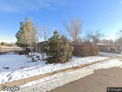
6199 Independence St Arvada, CO 80004
Alta Vista NeighborhoodEstimated Value: $642,000 - $750,000
4
Beds
3
Baths
2,565
Sq Ft
$262/Sq Ft
Est. Value
About This Home
This home is located at 6199 Independence St, Arvada, CO 80004 and is currently estimated at $670,929, approximately $261 per square foot. 6199 Independence St is a home located in Jefferson County with nearby schools including Arvada K-8, Arvada High School, and Lincoln Charter Academy.
Ownership History
Date
Name
Owned For
Owner Type
Purchase Details
Closed on
Apr 28, 2017
Sold by
Woodruff Rodoger A and Woodruff Susan A
Bought by
Thorstad Troy
Current Estimated Value
Home Financials for this Owner
Home Financials are based on the most recent Mortgage that was taken out on this home.
Original Mortgage
$364,900
Interest Rate
4.3%
Mortgage Type
New Conventional
Create a Home Valuation Report for This Property
The Home Valuation Report is an in-depth analysis detailing your home's value as well as a comparison with similar homes in the area
Home Values in the Area
Average Home Value in this Area
Purchase History
| Date | Buyer | Sale Price | Title Company |
|---|---|---|---|
| Thorstad Troy | $384,900 | Land Title Guarantee Co |
Source: Public Records
Mortgage History
| Date | Status | Borrower | Loan Amount |
|---|---|---|---|
| Open | Thorstad Troy | $342,000 | |
| Closed | Thorstad Troy | $364,900 | |
| Previous Owner | Woodruff Rodger A | $100,000 | |
| Previous Owner | Woodruff Rodger A | $50,000 | |
| Previous Owner | Woodruff Rodger A | $43,925 | |
| Previous Owner | Woodruff Rodger A | $37,000 | |
| Previous Owner | Woodruff Susan A | $32,296 | |
| Previous Owner | Woodruff Rodger A | $17,392 | |
| Previous Owner | Woodruff Rodger A | $26,705 |
Source: Public Records
Tax History Compared to Growth
Tax History
| Year | Tax Paid | Tax Assessment Tax Assessment Total Assessment is a certain percentage of the fair market value that is determined by local assessors to be the total taxable value of land and additions on the property. | Land | Improvement |
|---|---|---|---|---|
| 2024 | $3,678 | $37,914 | $18,680 | $19,234 |
| 2023 | $3,678 | $37,914 | $18,680 | $19,234 |
| 2022 | $2,956 | $30,181 | $13,332 | $16,849 |
| 2021 | $3,005 | $31,049 | $13,715 | $17,334 |
| 2020 | $2,661 | $27,577 | $11,313 | $16,264 |
| 2019 | $2,625 | $27,577 | $11,313 | $16,264 |
| 2018 | $2,461 | $25,132 | $7,163 | $17,969 |
| 2017 | $1,607 | $25,132 | $7,163 | $17,969 |
| 2016 | $1,224 | $20,827 | $6,595 | $14,232 |
| 2015 | $905 | $20,827 | $6,595 | $14,232 |
| 2014 | $905 | $16,899 | $5,731 | $11,168 |
Source: Public Records
Map
Nearby Homes
- 9639 W 63rd Place
- 6371 Iris Ct
- 6359 Brooks Dr
- 6026 Iris Way
- 6033 Hoyt Ct
- 9175 Cole Dr
- 6371 Brooks Dr
- 6190 Garrison St
- 9105 Oberon Rd Unit 2
- 6373 Johnson Way
- 9044 W 63rd Ave
- 6573 Iris St
- 6580 Independence Way
- 9487 W 58th Ave Unit C
- 6250 Everett Ct Unit F
- 6240 Everett Ct Unit F
- 6240 Everett Ct Unit B
- 10550 W 63rd Ave
- 8885 W 64th Place
- 6644 Kline St
