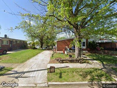
6212 Norvo Rd Gwynn Oak, MD 21207
Lochearn NeighborhoodEstimated Value: $232,000 - $305,000
--
Bed
2
Baths
1,158
Sq Ft
$231/Sq Ft
Est. Value
About This Home
This home is located at 6212 Norvo Rd, Gwynn Oak, MD 21207 and is currently estimated at $267,812, approximately $231 per square foot. 6212 Norvo Rd is a home located in Baltimore County with nearby schools including Powhatan Elementary School, Woodlawn Middle School, and Woodlawn High School.
Ownership History
Date
Name
Owned For
Owner Type
Purchase Details
Closed on
Jul 12, 2017
Sold by
Us Bank Na
Bought by
Cr Of Maryland V Llc
Current Estimated Value
Purchase Details
Closed on
Jun 5, 2017
Sold by
Nikquitto Gregory
Bought by
U S Bank Na
Purchase Details
Closed on
Apr 9, 2003
Sold by
Harvey Lillie M
Bought by
Nji Rita
Purchase Details
Closed on
Jun 5, 2002
Sold by
Harvey Lillie M
Bought by
Harvey Lillie M
Purchase Details
Closed on
Apr 26, 1968
Sold by
Sher Barnet and Sher Doris
Bought by
Harvey Lillie M
Create a Home Valuation Report for This Property
The Home Valuation Report is an in-depth analysis detailing your home's value as well as a comparison with similar homes in the area
Home Values in the Area
Average Home Value in this Area
Purchase History
| Date | Buyer | Sale Price | Title Company |
|---|---|---|---|
| Cr Of Maryland V Llc | $92,925 | Lakeside Title Co | |
| U S Bank Na | $214,955 | None Available | |
| Nji Rita | $107,000 | -- | |
| Harvey Lillie M | -- | -- | |
| Harvey Lillie M | $14,500 | -- |
Source: Public Records
Mortgage History
| Date | Status | Borrower | Loan Amount |
|---|---|---|---|
| Open | Cr Of Maryland V Llc | $17,600,000 | |
| Previous Owner | Nji Rita | $154,000 |
Source: Public Records
Tax History Compared to Growth
Tax History
| Year | Tax Paid | Tax Assessment Tax Assessment Total Assessment is a certain percentage of the fair market value that is determined by local assessors to be the total taxable value of land and additions on the property. | Land | Improvement |
|---|---|---|---|---|
| 2024 | $3,406 | $177,200 | $70,500 | $106,700 |
| 2023 | $3,518 | $168,567 | $0 | $0 |
| 2022 | $2,795 | $159,933 | $0 | $0 |
| 2021 | $1,738 | $151,300 | $43,600 | $107,700 |
| 2020 | $2,360 | $143,367 | $0 | $0 |
| 2019 | $1,641 | $135,433 | $0 | $0 |
| 2018 | $1,545 | $127,500 | $43,600 | $83,900 |
| 2017 | $2,340 | $127,400 | $0 | $0 |
| 2016 | -- | $127,300 | $0 | $0 |
| 2015 | $1,775 | $127,200 | $0 | $0 |
| 2014 | $1,775 | $127,200 | $0 | $0 |
Source: Public Records
Map
Nearby Homes
- 6110 Talles Rd
- 6301 Liberty Rd
- 3513 Old Mill Rd
- 3614 Telmar Rd
- 3421 Flannery Ln
- 6513 Liberty Rd
- 5427 Gradin Ave
- 3719 Patterson Ave
- 3724 Oak Ave
- 3205 Burnbrook Ln
- 6319 Seton Ridge Dr
- 6417 Woodgreen Cir
- 6615 Spring Mill Cir
- 5619 Wayne Ave
- 5514 Wesley Ave
- 6410 Laurel Dr
- 6804 Carol Rd
- 5511 Wesley Ave
- 3026 Essex Rd
- 6039 Gwynn Oak Ave