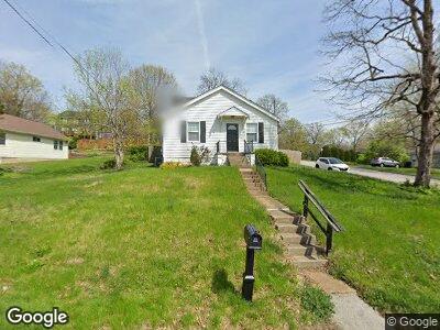
622 Edna Ave Unit A Saint Louis, MO 63122
Estimated Value: $136,000 - $938,000
--
Bed
--
Bath
--
Sq Ft
2,483
Sq Ft Lot
About This Home
This home is located at 622 Edna Ave Unit A, Saint Louis, MO 63122 and is currently estimated at $494,333. 622 Edna Ave Unit A is a home located in St. Louis County with nearby schools including George R. Robinson Elementary School, Nipher Middle School, and Kirkwood Senior High School.
Ownership History
Date
Name
Owned For
Owner Type
Purchase Details
Closed on
Apr 22, 2019
Sold by
Langston Michael S
Bought by
622 Edna Llc
Current Estimated Value
Purchase Details
Closed on
Jul 24, 2012
Sold by
Carbone Andrew T and Carbone Korisa J
Bought by
Langton Michael S
Home Financials for this Owner
Home Financials are based on the most recent Mortgage that was taken out on this home.
Original Mortgage
$152,000
Interest Rate
3.68%
Mortgage Type
VA
Purchase Details
Closed on
Feb 1, 2008
Sold by
Swengross Peggy Sue Johnson and Lutz Jane
Bought by
Carbone Andrew T and Carbone Korisa J
Purchase Details
Closed on
Oct 8, 2001
Sold by
Hasamear Matthew Todd and Hasamear Christina Elaine
Bought by
Hasamear Matthew Todd and Hasamear Christina Elaine
Home Financials for this Owner
Home Financials are based on the most recent Mortgage that was taken out on this home.
Original Mortgage
$141,200
Interest Rate
6.77%
Create a Home Valuation Report for This Property
The Home Valuation Report is an in-depth analysis detailing your home's value as well as a comparison with similar homes in the area
Home Values in the Area
Average Home Value in this Area
Purchase History
| Date | Buyer | Sale Price | Title Company |
|---|---|---|---|
| 622 Edna Llc | -- | Title Partners Agency Llc | |
| Langton Michael S | $152,000 | Multiple | |
| Carbone Andrew T | -- | None Available | |
| Hasamear Matthew Todd | -- | -- |
Source: Public Records
Mortgage History
| Date | Status | Borrower | Loan Amount |
|---|---|---|---|
| Previous Owner | Langton Michael S | $152,000 | |
| Previous Owner | Andrew Andrew T | $107,250 | |
| Previous Owner | Hasamear Matthew Todd | $141,200 |
Source: Public Records
Tax History Compared to Growth
Tax History
| Year | Tax Paid | Tax Assessment Tax Assessment Total Assessment is a certain percentage of the fair market value that is determined by local assessors to be the total taxable value of land and additions on the property. | Land | Improvement |
|---|---|---|---|---|
| 2024 | $53 | $860 | $860 | -- |
| 2023 | $53 | $860 | $860 | $0 |
| 2022 | $56 | $860 | $860 | $0 |
| 2021 | $56 | $860 | $860 | $0 |
| 2020 | $20 | $300 | $300 | $0 |
| 2019 | $20 | $300 | $300 | $0 |
| 2018 | $23 | $300 | $300 | $0 |
| 2017 | $23 | $300 | $300 | $0 |
| 2016 | $22 | $290 | $290 | $0 |
| 2015 | $22 | $290 | $290 | $0 |
| 2014 | $3 | $40 | $40 | $0 |
Source: Public Records
Map
Nearby Homes
- 1920 Hunting Lake Ct Unit 202
- 1932 Greenglen Dr Unit 303
- 1966 Hunting Lake Ct Unit 302
- 1996 Greenglen Dr Unit 103
- 1926 Greenpoint Dr
- 1963 Greenpoint Dr Unit 303
- 1934 Greenpoint Dr Unit 304
- 1948 Greenglen Dr Unit 302
- 1929 Greenpoint Dr Unit 301
- 1984 Greenglen Dr Unit 202
- 1925 W Woodbine Ave
- 2014 Greenglen Dr Unit 101
- 436 Emmerson Ave
- 2013 Lily Ave
- 401 S Ballas Rd
- 2017 Lily Ave
- 1520 Ann Ave
- 2021 Lily Ave
- 2025 Lily Ave
- 406 Meyer Ave