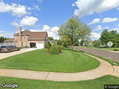
622 W Melissa Cir Morrisville, PA 19067
Lower Makefield NeighborhoodEstimated Value: $867,000 - $956,000
4
Beds
3
Baths
3,139
Sq Ft
$292/Sq Ft
Est. Value
About This Home
This home is located at 622 W Melissa Cir, Morrisville, PA 19067 and is currently estimated at $917,805, approximately $292 per square foot. 622 W Melissa Cir is a home located in Bucks County with nearby schools including Edgewood El School, Charles H. Boehm Middle School, and Pennsbury High School.
Ownership History
Date
Name
Owned For
Owner Type
Purchase Details
Closed on
Nov 2, 1992
Sold by
Winterfield Assoc L P
Bought by
Capuano Aniello and Capuano Maria E
Current Estimated Value
Purchase Details
Closed on
Oct 3, 1991
Bought by
Winterfield Assoc L P,
Create a Home Valuation Report for This Property
The Home Valuation Report is an in-depth analysis detailing your home's value as well as a comparison with similar homes in the area
Home Values in the Area
Average Home Value in this Area
Purchase History
| Date | Buyer | Sale Price | Title Company |
|---|---|---|---|
| Capuano Aniello | $242,200 | -- | |
| Winterfield Assoc L P, | $480,000 | -- |
Source: Public Records
Mortgage History
| Date | Status | Borrower | Loan Amount |
|---|---|---|---|
| Open | Capuano Aniello | $150,000 | |
| Open | Capuano Aniello | $504,000 | |
| Closed | Capuano Aniello | $136,000 | |
| Closed | Capuano Aniello | $112,000 | |
| Closed | Capuano Aniello | $420,000 | |
| Closed | Capuano Aniello | $435,000 | |
| Closed | Capuano Aniello | $400,000 | |
| Closed | Capuano Aniello | $200,000 |
Source: Public Records
Tax History Compared to Growth
Tax History
| Year | Tax Paid | Tax Assessment Tax Assessment Total Assessment is a certain percentage of the fair market value that is determined by local assessors to be the total taxable value of land and additions on the property. | Land | Improvement |
|---|---|---|---|---|
| 2025 | $13,007 | $54,930 | $12,440 | $42,490 |
| 2024 | $13,007 | $54,930 | $12,440 | $42,490 |
| 2023 | $12,354 | $54,930 | $12,440 | $42,490 |
| 2022 | $12,086 | $54,930 | $12,440 | $42,490 |
| 2021 | $11,894 | $54,930 | $12,440 | $42,490 |
| 2020 | $11,894 | $54,930 | $12,440 | $42,490 |
| 2019 | $11,658 | $54,930 | $12,440 | $42,490 |
| 2018 | $11,454 | $54,930 | $12,440 | $42,490 |
| 2017 | $11,100 | $54,930 | $12,440 | $42,490 |
| 2016 | $10,971 | $54,930 | $12,440 | $42,490 |
| 2015 | -- | $54,930 | $12,440 | $42,490 |
| 2014 | -- | $54,930 | $12,440 | $42,490 |
Source: Public Records
Map
Nearby Homes
- 613A Rose Hollow Dr
- 602B Rose Hollow Dr
- 1626 Covington Rd Unit 13
- 632 Wrensong Rd
- 538 Heritage Oak Dr
- 1767 Langhorne Yardley Rd
- 1501 Revere Rd
- 620B Palmer Ln
- 785 Sumter Dr
- 1850 Windflower Ln
- 1561 Silo Rd
- 1821 Windflower Ln
- 3402 Waltham Ct
- 5508 Spruce Mill Dr Unit 415
- 2404 Brookhaven Dr Unit 330
- 2405 Brookhaven Dr Unit 331
- 6003 Spruce Mill Dr Unit 436
- 2901 Brookhaven Dr Unit 361
- 503 Palmer Farm Dr
- 0 Oxford Valley Rd Unit PABU2052468