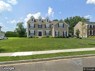
635 Meehan Dr Warrington, PA 18976
Warrington NeighborhoodEstimated Value: $1,046,324 - $1,240,000
4
Beds
4
Baths
3,998
Sq Ft
$293/Sq Ft
Est. Value
About This Home
This home is located at 635 Meehan Dr, Warrington, PA 18976 and is currently estimated at $1,173,331, approximately $293 per square foot. 635 Meehan Dr is a home with nearby schools including Mill Creek Elementary School, Unami Middle School, and Central Bucks High School - South.
Ownership History
Date
Name
Owned For
Owner Type
Purchase Details
Closed on
Feb 7, 2017
Sold by
Toll Pa Xiv Lp
Bought by
Leach Andrew M and Leach Melissa
Current Estimated Value
Home Financials for this Owner
Home Financials are based on the most recent Mortgage that was taken out on this home.
Original Mortgage
$583,243
Outstanding Balance
$496,533
Interest Rate
4.2%
Mortgage Type
New Conventional
Estimated Equity
$636,412
Create a Home Valuation Report for This Property
The Home Valuation Report is an in-depth analysis detailing your home's value as well as a comparison with similar homes in the area
Home Values in the Area
Average Home Value in this Area
Purchase History
| Date | Buyer | Sale Price | Title Company |
|---|---|---|---|
| Leach Andrew M | $729,054 | Westminister Abstract Co |
Source: Public Records
Mortgage History
| Date | Status | Borrower | Loan Amount |
|---|---|---|---|
| Open | Leach Andrew M | $583,243 |
Source: Public Records
Tax History Compared to Growth
Tax History
| Year | Tax Paid | Tax Assessment Tax Assessment Total Assessment is a certain percentage of the fair market value that is determined by local assessors to be the total taxable value of land and additions on the property. | Land | Improvement |
|---|---|---|---|---|
| 2024 | $13,123 | $71,090 | $10,470 | $60,620 |
| 2023 | $12,150 | $71,090 | $10,470 | $60,620 |
| 2022 | $11,910 | $71,090 | $10,470 | $60,620 |
| 2021 | $11,777 | $71,090 | $10,470 | $60,620 |
| 2020 | $11,777 | $71,090 | $10,470 | $60,620 |
| 2019 | $11,706 | $71,090 | $10,470 | $60,620 |
| 2018 | $11,576 | $71,090 | $10,470 | $60,620 |
| 2017 | $1,345 | $71,090 | $10,470 | $60,620 |
| 2016 | $1,340 | $8,370 | $8,370 | $0 |
| 2015 | -- | $8,370 | $8,370 | $0 |
Source: Public Records
Map
Nearby Homes
- 143 S Founders Ct
- 153 S Founders Ct
- 501 Fullerton Farm Ct Lot #30
- 502 McNaney Farm Dr Lot #25
- 504
- 530 Fullerton Farm Court Lot#10
- 513 McNaney Farm Dr Lot #7
- 506 McNaney Farm Dr Lot # 27
- 528 Fullerton Farm Ct
- 515 McNaney Farm Dr #8
- 511 McNaney Farm Dr Lot #6
- 1701 Nottingham Ct Unit 131
- 1607 Highgrove Ct Unit 127
- 731 Russells Way
- 651 N Settlers Cir
- 411 Homestead Cir
- 513 Tara Ct
- 206 Trellis Dr
- 2710 Harvard Dr
- 3146 Wier Dr E Unit 50