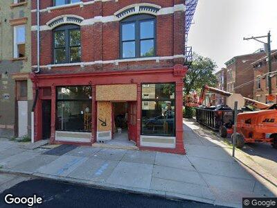
642 Neave St Cincinnati, OH 45204
East Price Hill Neighborhood
--
Bed
5
Baths
5,645
Sq Ft
1,742
Sq Ft Lot
About This Home
This home is located at 642 Neave St, Cincinnati, OH 45204. 642 Neave St is a home located in Hamilton County with nearby schools including Oyler School, Robert A. Taft Information Technology High School, and Gilbert A. Dater High School.
Ownership History
Date
Name
Owned For
Owner Type
Purchase Details
Closed on
Jul 29, 2021
Sold by
Iover The Rhine Community Housing
Bought by
Lph Thrives Llc
Home Financials for this Owner
Home Financials are based on the most recent Mortgage that was taken out on this home.
Original Mortgage
$0
Interest Rate
2.8%
Mortgage Type
New Conventional
Purchase Details
Closed on
Aug 13, 2020
Sold by
Sondhi Ramesh C and Sondhi Meena
Bought by
Over The Rhine Community Housing
Home Financials for this Owner
Home Financials are based on the most recent Mortgage that was taken out on this home.
Original Mortgage
$380,000
Interest Rate
3%
Mortgage Type
Commercial
Create a Home Valuation Report for This Property
The Home Valuation Report is an in-depth analysis detailing your home's value as well as a comparison with similar homes in the area
Home Values in the Area
Average Home Value in this Area
Purchase History
| Date | Buyer | Sale Price | Title Company |
|---|---|---|---|
| Lph Thrives Llc | $220,000 | None Available | |
| Over The Rhine Community Housing | $170,000 | None Available |
Source: Public Records
Mortgage History
| Date | Status | Borrower | Loan Amount |
|---|---|---|---|
| Open | Lph Thrives Llc | $945,000 | |
| Closed | Lph Thrives Llc | $1,000,000 | |
| Closed | First Financial Bank | $0 | |
| Closed | Lph Thrives Llc | $1,000,000 | |
| Closed | Lph Thrives Llc | $250,000 | |
| Previous Owner | Over The Rhine Community Housing | $380,000 |
Source: Public Records
Tax History Compared to Growth
Tax History
| Year | Tax Paid | Tax Assessment Tax Assessment Total Assessment is a certain percentage of the fair market value that is determined by local assessors to be the total taxable value of land and additions on the property. | Land | Improvement |
|---|---|---|---|---|
| 2024 | $4,721 | $130,253 | $2,919 | $127,334 |
| 2023 | $7,627 | $92,526 | $2,919 | $89,607 |
| 2022 | $1,098 | $11,768 | $2,475 | $9,293 |
| 2021 | $1,069 | $11,768 | $2,475 | $9,293 |
| 2020 | $1,070 | $11,768 | $2,475 | $9,293 |
| 2019 | $1,093 | $11,103 | $2,335 | $8,768 |
| 2018 | $1,094 | $11,103 | $2,335 | $8,768 |
| 2017 | $1,058 | $11,103 | $2,335 | $8,768 |
| 2016 | $1,570 | $16,241 | $2,377 | $13,864 |
| 2015 | $1,444 | $16,241 | $2,377 | $13,864 |
| 2014 | $1,449 | $16,241 | $2,377 | $13,864 |
| 2013 | $1,482 | $16,573 | $2,426 | $14,147 |
Source: Public Records
Map
Nearby Homes
- 2128 Saint Michael St
- 810 Matson Place
- 558 Davenport Ave
- 2617 Eighth St W
- 824 Matson Place
- 2312 Wilder Ave
- 2403 Elberon Ave
- 2500 Warsaw Ave
- 2506 Warsaw Ave
- 2712 Morrow Place
- 3107 Eighth St W
- 552 Considine Ave
- 11 Carneal St
- 741 Considine Ave
- 410 Somerset St
- 817 Considine Ave
- 40 Carneal St
- 42 Euclid St
- 50 Elm St
- 2856 Sterrett Ave