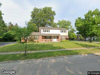
6471 Tonbridge St Worthington, OH 43085
Estimated Value: $541,709 - $648,000
3
Beds
3
Baths
2,240
Sq Ft
$264/Sq Ft
Est. Value
About This Home
This home is located at 6471 Tonbridge St, Worthington, OH 43085 and is currently estimated at $591,177, approximately $263 per square foot. 6471 Tonbridge St is a home located in Franklin County with nearby schools including Evening Street Elementary School, Kilbourne Middle School, and Thomas Worthington High School.
Ownership History
Date
Name
Owned For
Owner Type
Purchase Details
Closed on
Mar 30, 2018
Sold by
Estate Of Florence Maureen Roop
Bought by
Roop Thomas A and The Maureen Roop Revocable Trust
Current Estimated Value
Purchase Details
Closed on
Jun 14, 2007
Sold by
Estate Of Donald Earl Roop
Bought by
Roop Florence Maureen
Purchase Details
Closed on
Jun 16, 1966
Bought by
Roop Donald E and Roop Maureen F
Create a Home Valuation Report for This Property
The Home Valuation Report is an in-depth analysis detailing your home's value as well as a comparison with similar homes in the area
Home Values in the Area
Average Home Value in this Area
Purchase History
| Date | Buyer | Sale Price | Title Company |
|---|---|---|---|
| Roop Thomas A | -- | None Available | |
| Roop Florence Maureen | -- | None Available | |
| Roop Donald E | -- | -- |
Source: Public Records
Tax History Compared to Growth
Tax History
| Year | Tax Paid | Tax Assessment Tax Assessment Total Assessment is a certain percentage of the fair market value that is determined by local assessors to be the total taxable value of land and additions on the property. | Land | Improvement |
|---|---|---|---|---|
| 2024 | $10,394 | $160,580 | $61,320 | $99,260 |
| 2023 | $9,962 | $160,580 | $61,320 | $99,260 |
| 2022 | $10,074 | $129,720 | $44,420 | $85,300 |
| 2021 | $9,331 | $129,720 | $44,420 | $85,300 |
| 2020 | $9,005 | $129,720 | $44,420 | $85,300 |
| 2019 | $8,627 | $112,390 | $44,420 | $67,970 |
| 2018 | $7,810 | $112,390 | $44,420 | $67,970 |
| 2017 | $7,513 | $112,390 | $44,420 | $67,970 |
| 2016 | $7,246 | $96,500 | $38,850 | $57,650 |
| 2015 | $7,247 | $96,500 | $38,850 | $57,650 |
| 2014 | $7,245 | $96,500 | $38,850 | $57,650 |
| 2013 | $3,437 | $91,910 | $36,995 | $54,915 |
Source: Public Records
Map
Nearby Homes
- 355 Longfellow Ave
- 315 Highgate Ave
- 321 Hennessey Ave
- 6660 Hayhurst St
- 6710 Hayhurst St
- 6500 Plesenton Dr
- 6876 Bowerman St E
- 91 Glen Dr
- 6909 Olentangy River Rd
- 209 Saint Jacques St Unit 21A
- 135 Glen Cir
- 125 Saint Julien St Unit 30A
- 120 Caren Ave
- 130 Saint Julien St Unit 27B
- 108 E Dublin Granville Rd Unit F
- 941 Macgregor Ave
- 1900 Snouffer Rd
- 1040 Kirk Ave
- 260 E Stafford Ave
- 31 Howard Ave