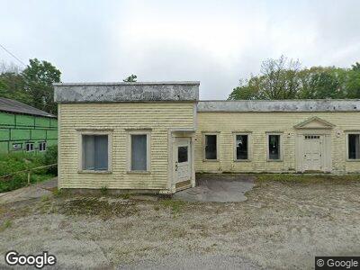
65 W Main St Bradford, NH 03221
Bradford NeighborhoodEstimated Value: $376,472
--
Bed
1
Bath
9,582
Sq Ft
$39/Sq Ft
Est. Value
About This Home
This home is located at 65 W Main St, Bradford, NH 03221 and is currently estimated at $376,472, approximately $39 per square foot. 65 W Main St is a home located in Merrimack County with nearby schools including Kearsarge Regional Elementary School at Bradford, Kearsarge Regional Middle School, and Kearsarge Regional High School.
Ownership History
Date
Name
Owned For
Owner Type
Purchase Details
Closed on
Jan 12, 2022
Sold by
De & S 2 Nh 18 Llc
Bought by
Wolfpack Investments Llc
Current Estimated Value
Home Financials for this Owner
Home Financials are based on the most recent Mortgage that was taken out on this home.
Original Mortgage
$150,000
Outstanding Balance
$140,392
Interest Rate
3.05%
Mortgage Type
Purchase Money Mortgage
Estimated Equity
$240,935
Purchase Details
Closed on
Dec 20, 2018
Sold by
Kerkove Llc
Bought by
De & S 02Nh18 Llc
Home Financials for this Owner
Home Financials are based on the most recent Mortgage that was taken out on this home.
Original Mortgage
$204,000
Interest Rate
4.9%
Create a Home Valuation Report for This Property
The Home Valuation Report is an in-depth analysis detailing your home's value as well as a comparison with similar homes in the area
Home Values in the Area
Average Home Value in this Area
Purchase History
| Date | Buyer | Sale Price | Title Company |
|---|---|---|---|
| Wolfpack Investments Llc | $300,000 | None Available | |
| De & S 02Nh18 Llc | $255,000 | -- |
Source: Public Records
Mortgage History
| Date | Status | Borrower | Loan Amount |
|---|---|---|---|
| Open | Wolfpack Investments Llc | $150,000 | |
| Closed | Wolfpack Investments Llc | $120,000 | |
| Closed | Wolfpack Investments Llc | $126,000 | |
| Previous Owner | De & S 02Nh18 Llc | $204,000 |
Source: Public Records
Tax History Compared to Growth
Tax History
| Year | Tax Paid | Tax Assessment Tax Assessment Total Assessment is a certain percentage of the fair market value that is determined by local assessors to be the total taxable value of land and additions on the property. | Land | Improvement |
|---|---|---|---|---|
| 2024 | $5,502 | $349,800 | $150,600 | $199,200 |
| 2023 | $7,445 | $267,800 | $69,000 | $198,800 |
| 2022 | $6,612 | $267,800 | $69,000 | $198,800 |
| 2021 | $6,403 | $267,800 | $69,000 | $198,800 |
| 2020 | $6,390 | $267,800 | $69,000 | $198,800 |
| 2019 | $7,979 | $285,900 | $52,200 | $233,700 |
| 2018 | $7,337 | $277,900 | $52,200 | $225,700 |
| 2017 | $7,259 | $277,900 | $52,200 | $225,700 |
| 2016 | $7,337 | $277,900 | $52,200 | $225,700 |
| 2015 | $7,492 | $277,900 | $52,200 | $225,700 |
| 2014 | $6,423 | $276,000 | $80,100 | $195,900 |
| 2013 | $6,188 | $276,000 | $80,100 | $195,900 |
Source: Public Records
Map
Nearby Homes
- 3 Steele Rd
- 5 Greenhouse Ln
- 19 Center Rd
- 311 Fairgrounds Rd
- 82 Breezy Hill Rd
- 44 Pleasant View Rd
- 00 Fairgrounds Rd
- 16-66 Bagley Hill Rd
- 420 Sutton Rd
- 85 Richards Rd
- 2400 Route 114
- Lot 194-58 Route 114
- 2024 Route 114
- 000 Route 114
- 12 Chapin Way Unit Lot 12
- 6 Chapin Way Unit 6
- 0 Crest Dr Unit 4996159
- 00 Meadow Rd
- 121 Old Post Rd
- 0 Roby Unit 5036005