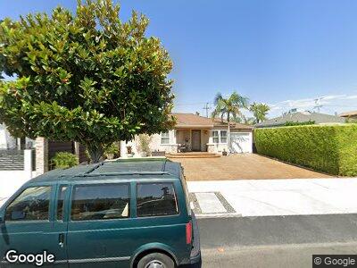
6519 Kraft Ave North Hollywood, CA 91606
North Hollywood NeighborhoodEstimated Value: $785,000 - $906,000
3
Beds
2
Baths
1,213
Sq Ft
$707/Sq Ft
Est. Value
About This Home
This home is located at 6519 Kraft Ave, North Hollywood, CA 91606 and is currently estimated at $857,820, approximately $707 per square foot. 6519 Kraft Ave is a home located in Los Angeles County with nearby schools including Fair Avenue Elementary School, Roy Romer Middle School, and North Hollywood Senior High School.
Ownership History
Date
Name
Owned For
Owner Type
Purchase Details
Closed on
Mar 21, 2007
Sold by
Kostenberger Otto
Bought by
Coberg Oto Amaral and Coberg Silvia Helena Amaral
Current Estimated Value
Purchase Details
Closed on
Dec 11, 1996
Sold by
Scheinhaus Myron
Bought by
Kostenberger Oltto and Engler Silvia Helena
Purchase Details
Closed on
Jun 5, 1996
Sold by
Scheinhaus Myron
Bought by
Scheinhaus Myron and Myron Scheinhaus Living Trust
Create a Home Valuation Report for This Property
The Home Valuation Report is an in-depth analysis detailing your home's value as well as a comparison with similar homes in the area
Home Values in the Area
Average Home Value in this Area
Purchase History
| Date | Buyer | Sale Price | Title Company |
|---|---|---|---|
| Coberg Oto Amaral | -- | None Available | |
| Kostenberger Oltto | $125,000 | Old Republic Title Co | |
| Scheinhaus Myron | -- | -- |
Source: Public Records
Mortgage History
| Date | Status | Borrower | Loan Amount |
|---|---|---|---|
| Open | Coberg Oto Amaral | $413,548 | |
| Closed | Kostenberger Otto | $103,000 | |
| Closed | Coberg Oto A | $140,000 | |
| Closed | Kostenberger Otto | $0 |
Source: Public Records
Tax History Compared to Growth
Tax History
| Year | Tax Paid | Tax Assessment Tax Assessment Total Assessment is a certain percentage of the fair market value that is determined by local assessors to be the total taxable value of land and additions on the property. | Land | Improvement |
|---|---|---|---|---|
| 2024 | $3,477 | $274,370 | $100,422 | $173,948 |
| 2023 | $3,412 | $268,991 | $98,453 | $170,538 |
| 2022 | $3,256 | $263,718 | $96,523 | $167,195 |
| 2021 | $3,211 | $258,548 | $94,631 | $163,917 |
| 2019 | $3,116 | $250,881 | $91,825 | $159,056 |
| 2018 | $3,022 | $245,963 | $90,025 | $155,938 |
| 2016 | $2,876 | $236,414 | $86,530 | $149,884 |
| 2015 | $2,834 | $232,864 | $85,231 | $147,633 |
| 2014 | $2,851 | $228,304 | $83,562 | $144,742 |
Source: Public Records
Map
Nearby Homes
- 0 Tujunga Ave
- 11554 Haynes St
- 11341 Victory Blvd
- 6651 Farmdale Ave
- 11324 W Raitt Ln
- 6711 Tujunga Ave
- 11300 Victory Blvd
- 6334 Beck Ave
- 6732 Farmdale Ave
- 6355 Elmer Ave
- 6727 Camellia Ave
- 6726 Beck Ave
- 6709 Lemp Ave
- 11618 Friar St
- 6743 Irvine Ave
- 6320 Fair Ave
- 11488 Erwin St
- 6510 N Contour Ln
- 6503 N Contour Ln
- 11025 Kittridge St Unit 128