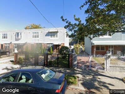
653 Williams Ave Brooklyn, NY 11207
Brownsville NeighborhoodEstimated Value: $577,153 - $701,000
--
Bed
--
Bath
1,300
Sq Ft
$492/Sq Ft
Est. Value
About This Home
This home is located at 653 Williams Ave, Brooklyn, NY 11207 and is currently estimated at $639,288, approximately $491 per square foot. 653 Williams Ave is a home located in Kings County with nearby schools including P.S. 190 - Sheffield, Achievement First - East New York School, and Uncommon Brownsville South Elementary School and Middle School.
Ownership History
Date
Name
Owned For
Owner Type
Purchase Details
Closed on
Dec 19, 2000
Sold by
Nehemiah Housing Development Fund Co Inc
Bought by
Taylor Robin P
Current Estimated Value
Home Financials for this Owner
Home Financials are based on the most recent Mortgage that was taken out on this home.
Original Mortgage
$85,000
Interest Rate
7.52%
Create a Home Valuation Report for This Property
The Home Valuation Report is an in-depth analysis detailing your home's value as well as a comparison with similar homes in the area
Home Values in the Area
Average Home Value in this Area
Purchase History
| Date | Buyer | Sale Price | Title Company |
|---|---|---|---|
| Taylor Robin P | $110,000 | First American Title Ins Co |
Source: Public Records
Mortgage History
| Date | Status | Borrower | Loan Amount |
|---|---|---|---|
| Open | Taylor Robin P | $259,000 | |
| Closed | Taylor Robin P | $85,000 | |
| Closed | Taylor Robin P | $20,000 |
Source: Public Records
Tax History Compared to Growth
Tax History
| Year | Tax Paid | Tax Assessment Tax Assessment Total Assessment is a certain percentage of the fair market value that is determined by local assessors to be the total taxable value of land and additions on the property. | Land | Improvement |
|---|---|---|---|---|
| 2024 | $4,785 | $34,020 | $12,660 | $21,360 |
| 2023 | $4,549 | $34,080 | $12,660 | $21,420 |
| 2022 | $4,195 | $27,420 | $12,660 | $14,760 |
| 2021 | $4,161 | $21,180 | $12,660 | $8,520 |
| 2020 | $3,121 | $23,220 | $10,439 | $12,781 |
| 2019 | $4,030 | $23,220 | $10,439 | $12,781 |
| 2018 | $3,911 | $25,020 | $10,439 | $14,581 |
| 2017 | $3,704 | $25,776 | $10,439 | $15,337 |
| 2016 | $3,039 | $24,422 | $9,085 | $15,337 |
| 2015 | $828 | $23,040 | $7,703 | $15,337 |
| 2014 | $828 | $23,040 | $7,703 | $15,337 |
Source: Public Records
Map
Nearby Homes
- 230 New Lots Ave
- 632 Alabama Ave
- 610 Alabama Ave
- 606 Alabama Ave
- 657 Snediker Ave
- 584 Hinsdale St
- 1825 Linden Blvd
- 1755 Linden Blvd
- 1753 Linden Blvd
- 641 Georgia Ave
- 578 Williams Ave
- 576 Williams Ave
- 484 Hegeman Ave
- 610 Sheffield Ave
- 90 Louisiana Ave
- 661 Sheffield Ave
- 748 Georgia Ave
- 603 Sheffield Ave
- 521 Hegeman Ave
- 694 Pennsylvania Ave