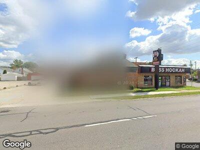
6530 Greenfield Rd Dearborn, MI 48126
Ford Woods NeighborhoodEstimated Value: $573,489
--
Bed
--
Bath
3,636
Sq Ft
$158/Sq Ft
Est. Value
About This Home
This home is located at 6530 Greenfield Rd, Dearborn, MI 48126 and is currently estimated at $573,489, approximately $157 per square foot. 6530 Greenfield Rd is a home located in Wayne County with nearby schools including Maples Elementary School, Stout Middle School, and Dearborn High School.
Ownership History
Date
Name
Owned For
Owner Type
Purchase Details
Closed on
Oct 24, 2023
Sold by
F D J Investment Llc
Bought by
Salah H Hazimi & Zeinab S Hazimi Revocable Li
Current Estimated Value
Purchase Details
Closed on
Jul 26, 2012
Sold by
Farha Sami Abu and Farha Safa Abu
Bought by
F D J Investment Llc
Purchase Details
Closed on
Oct 29, 2009
Sold by
Tabaja Hussein
Bought by
Farha Dr Sami Abu
Purchase Details
Closed on
Mar 3, 2005
Sold by
Sobh Alex M and Sobh Safi M
Bought by
Abu Farha Sami
Create a Home Valuation Report for This Property
The Home Valuation Report is an in-depth analysis detailing your home's value as well as a comparison with similar homes in the area
Home Values in the Area
Average Home Value in this Area
Purchase History
| Date | Buyer | Sale Price | Title Company |
|---|---|---|---|
| Salah H Hazimi & Zeinab S Hazimi Revocable Li | $525,000 | None Listed On Document | |
| F D J Investment Llc | -- | None Available | |
| Farha Dr Sami Abu | -- | None Available | |
| Abu Farha Sami | $304,968 | -- |
Source: Public Records
Mortgage History
| Date | Status | Borrower | Loan Amount |
|---|---|---|---|
| Previous Owner | Sobh Safi | $225,000 |
Source: Public Records
Tax History Compared to Growth
Tax History
| Year | Tax Paid | Tax Assessment Tax Assessment Total Assessment is a certain percentage of the fair market value that is determined by local assessors to be the total taxable value of land and additions on the property. | Land | Improvement |
|---|---|---|---|---|
| 2024 | $16,611 | $242,700 | $0 | $0 |
| 2023 | $9,848 | $235,700 | $0 | $0 |
| 2022 | $11,338 | $237,600 | $0 | $0 |
| 2021 | $12,962 | $219,500 | $0 | $0 |
| 2019 | $13,184 | $198,400 | $0 | $0 |
| 2018 | $11,383 | $186,200 | $0 | $0 |
| 2017 | $2,341 | $152,100 | $0 | $0 |
| 2015 | $14,427 | $144,850 | $0 | $0 |
| 2013 | $14,200 | $142,000 | $0 | $0 |
| 2011 | -- | $151,050 | $0 | $0 |
Source: Public Records
Map
Nearby Homes
- 6620 Coleman St
- 6404 Yinger Ave
- 6934 Coleman St
- 6544 Rutherford St
- 7410 Barrie St
- 6624 Mead St
- 6115 Yinger Ave
- 5530 Mead St
- 6535 Orchard Ave
- 7309 Payne Ave
- 6536 Asbury Park
- 7285 Mansfield St
- 7262 Saint Marys St
- 7519 Barrie St
- 6413 Kenilworth St
- 6000 Orchard Ave
- 7519 Orchard Ave
- 6739 Grandmont Ave
- 7415 Mettetal St
- 7630 Steadman St
