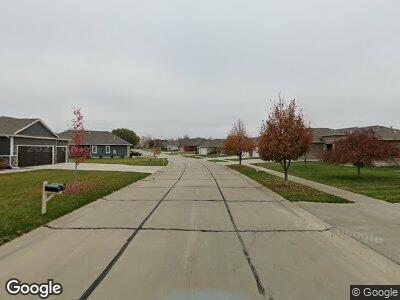
656 Bluestem Trail North Sioux City, SD 57049
Dakota Dunes NeighborhoodEstimated Value: $523,000 - $571,649
5
Beds
--
Bath
2,144
Sq Ft
$257/Sq Ft
Est. Value
About This Home
This home is located at 656 Bluestem Trail, North Sioux City, SD 57049 and is currently estimated at $551,412, approximately $257 per square foot. 656 Bluestem Trail is a home with nearby schools including Dakota Valley Elementary School, Dakota Valley Junior High School, and Dakota Valley High School.
Ownership History
Date
Name
Owned For
Owner Type
Purchase Details
Closed on
Oct 1, 2013
Sold by
Vaughan Terry J and Vaughan Laura
Bought by
Holub David J and Holub Linda M
Current Estimated Value
Home Financials for this Owner
Home Financials are based on the most recent Mortgage that was taken out on this home.
Original Mortgage
$50,000
Interest Rate
4.59%
Mortgage Type
Unknown
Purchase Details
Closed on
Nov 5, 2009
Sold by
Dakota Dunes Development Company
Bought by
Augustine Richar R and Augustine Nancy A
Home Financials for this Owner
Home Financials are based on the most recent Mortgage that was taken out on this home.
Original Mortgage
$38,000
Interest Rate
5.11%
Mortgage Type
Purchase Money Mortgage
Create a Home Valuation Report for This Property
The Home Valuation Report is an in-depth analysis detailing your home's value as well as a comparison with similar homes in the area
Home Values in the Area
Average Home Value in this Area
Purchase History
| Date | Buyer | Sale Price | Title Company |
|---|---|---|---|
| Holub David J | $47,500 | None Available | |
| Augustine Richar R | $47,500 | None Available |
Source: Public Records
Mortgage History
| Date | Status | Borrower | Loan Amount |
|---|---|---|---|
| Open | Holub David Jerry | $225,000 | |
| Closed | Holub David J | $50,000 | |
| Closed | Holub David J | $120,000 | |
| Previous Owner | Augustine Richar R | $38,000 |
Source: Public Records
Tax History Compared to Growth
Tax History
| Year | Tax Paid | Tax Assessment Tax Assessment Total Assessment is a certain percentage of the fair market value that is determined by local assessors to be the total taxable value of land and additions on the property. | Land | Improvement |
|---|---|---|---|---|
| 2024 | $7,761 | $497,787 | $52,250 | $445,537 |
| 2023 | $7,810 | $497,787 | $52,250 | $445,537 |
| 2022 | $7,035 | $457,284 | $52,250 | $405,034 |
| 2021 | $6,983 | $415,713 | $47,500 | $368,213 |
| 2020 | $6,676 | $398,179 | $47,500 | $350,679 |
| 2019 | $6,152 | $381,480 | $47,500 | $333,980 |
| 2018 | $6,256 | $365,576 | $47,500 | $318,076 |
| 2017 | $6,150 | $365,576 | $0 | $365,576 |
| 2016 | $6,468 | $365,576 | $0 | $365,576 |
| 2015 | $6,468 | $365,576 | $0 | $365,576 |
| 2014 | $1,117 | $47,500 | $47,500 | $0 |
| 2013 | $1,143 | $47,500 | $47,500 | $0 |
| 2012 | $1,143 | $47,500 | $47,500 | $0 |
Source: Public Records
Map
Nearby Homes
- 584 Bluestem Trail
- 715 Monterey Trail
- 685 Arrowhead Ct
- 279 Levee Trail
- 874 N Spanish Bay
- 466 Firethorn Trail
- 165 Prairie Bend
- 104 Teton Pines Ct
- 162 Teton Pines Ct
- 709 Cherry Hills Ln
- 703 W Timber Rd
- 753 Crooked Tree Ln
- 932 Spyglass Ct
- 961 Quail Hollow Cir
- 954 Quail Hollow Cir
- 343 Partridge Cir
- 865 Crooked Tree Ln
- 13 Edgewater Ln
- 998 Quail Hollow Cir
- 297 Augusta Cir
