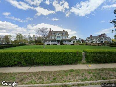
660 Gulf St Milford, CT 06460
Woodmont NeighborhoodEstimated Value: $2,299,462 - $2,406,000
5
Beds
5
Baths
6,160
Sq Ft
$383/Sq Ft
Est. Value
About This Home
This home is located at 660 Gulf St, Milford, CT 06460 and is currently estimated at $2,360,821, approximately $383 per square foot. 660 Gulf St is a home located in New Haven County with nearby schools including Calf Pen Meadow Elementary School, East Shore Middle School, and Joseph A. Foran High School.
Ownership History
Date
Name
Owned For
Owner Type
Purchase Details
Closed on
Jun 11, 2002
Sold by
Murray William P and Murray Elizabeth M
Bought by
Patrick Family Lp
Current Estimated Value
Purchase Details
Closed on
Oct 29, 1997
Sold by
Meaney Keith C and Meaney Aileen M
Bought by
Patrick Daniel and Patrick Susan G
Home Financials for this Owner
Home Financials are based on the most recent Mortgage that was taken out on this home.
Original Mortgage
$640,000
Interest Rate
7%
Mortgage Type
Unknown
Create a Home Valuation Report for This Property
The Home Valuation Report is an in-depth analysis detailing your home's value as well as a comparison with similar homes in the area
Home Values in the Area
Average Home Value in this Area
Purchase History
| Date | Buyer | Sale Price | Title Company |
|---|---|---|---|
| Patrick Family Lp | $197,000 | -- | |
| Patrick Family Lp | $197,000 | -- | |
| Patrick Daniel | $800,000 | -- | |
| Patrick Daniel | $800,000 | -- |
Source: Public Records
Mortgage History
| Date | Status | Borrower | Loan Amount |
|---|---|---|---|
| Closed | Patrick Daniel | $417,000 | |
| Closed | Patrick Daniel | $500,000 | |
| Previous Owner | Patrick Daniel | $640,000 |
Source: Public Records
Tax History Compared to Growth
Tax History
| Year | Tax Paid | Tax Assessment Tax Assessment Total Assessment is a certain percentage of the fair market value that is determined by local assessors to be the total taxable value of land and additions on the property. | Land | Improvement |
|---|---|---|---|---|
| 2024 | $53,161 | $1,824,320 | $752,570 | $1,071,750 |
| 2023 | $49,567 | $1,824,320 | $752,570 | $1,071,750 |
| 2022 | $48,618 | $1,824,320 | $752,570 | $1,071,750 |
| 2021 | $44,820 | $1,620,960 | $662,480 | $958,480 |
| 2020 | $44,868 | $1,620,960 | $662,480 | $958,480 |
| 2019 | $44,917 | $1,620,960 | $662,480 | $958,480 |
| 2018 | $44,965 | $1,620,960 | $662,480 | $958,480 |
| 2017 | $45,046 | $1,620,960 | $662,480 | $958,480 |
| 2016 | $44,426 | $1,595,760 | $628,670 | $967,090 |
| 2015 | $44,490 | $1,595,760 | $628,670 | $967,090 |
| 2014 | $43,437 | $1,595,760 | $628,670 | $967,090 |
Source: Public Records
Map
Nearby Homes
- 52 Point Lookout
- 590 Gulf St
- 19 Lawrence Ave
- 36 Deerfield Ave
- 6 Warren Dr
- 7 Orland St
- 87 Trumbull Ave Unit 5
- 87 Trumbull Ave Unit 4
- 74 Indian River Rd
- 91 Shelter Cove Rd
- 139 Rogers Ave
- 289 Gulf St
- 126 Bryan Hill Rd
- 44 Chester St
- 47 Beachland Ave
- 67 Long Island View Rd
- 109 Bryan Hill Rd
- 304 Mariners Walk Unit 304
- 104 Seaside Ave Unit H
- 30 Surf Ave